
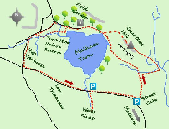
Last week was a walk round Grimwith Reservoir. This week is another circuit of the highest freshwater (glacial) lakes in England. A walk round Malham Tarn includes a section along the shores, through the woods and peaceful lanes. Take the option to pop up Great Close Hill to complete a perfect day.
I often park near Streetgate but it is just as easy to park half a mile to the west at the outflow of Malham Tarn where there is a larger (free) car park.
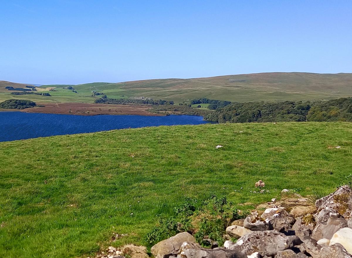
From the multi finger sign at Streetgate head north along a wide track for a third of a mile until the path splits. There is a choice at this point. Continue along the track and soon arrive at the clear waters of Malham Tarn, at 378 metres the highest marl (calcium carbonate/lime rich mud) lake in England. It may have been larger in the past, with geologists believing the original lake included Tarn Moss to the west. The path continues lakeside for a few hundred metres with wonderful views (on a clear day) across the waters.

Alternatively, fork right and after a gate joining a footpath which leads to the summit of Great Close Hill. Here the views are superb and along with the relics of an iron age fort, makes for an excellent resting spot. To descend do not aim directly for the lake but head north along a faint path to a join in paths, turn left and join the path along the shoreline.

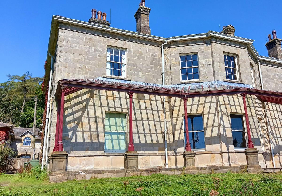
A gate leads into the woods of the Malham Tarn estate, owned and managed by the National Trust. In the centre of the woods is a fine building. Originally a hunting lodge it was added to in both Georgian and Victorian times to make up today's impressive building.
Carry on through the woods until you reach a path heading south onto some duck boards and an area of wonderful wetland walking. Here is the domain of lapwings, oyster catchers, curlews and other wetland birds.

On emerging from the nature reserve join one of the quiet roads which will complete the west and southern part of the circuit. You cannot lose your way, whenever you come to any road junction just turn left!
As you approach the outflow of Malham Tarn (just before the bridge) it is worth making the detour for 200 metres south to Water Sinks where the lively stream disappears down into the ground, only to appear much further down the valley, beyond Malham Cove. Return to the bridge, and carry on west for a further three quarters of a mile to Streetgate.
WALK FACTS:
Distance: Roughly five miles (excluding visiting Water Sinks and Great Close).
Height to climb: 80m (260 feet).
Start: SD 904656. Park at Streetgate or Water Sinks. This avoids the busy parking at Malham.
Difficulty: Easy. The route is flat (unless you climb Great Close Hill and the tracks/roads easy to walk on.
Refreshments: Malham is a two mile drive from Streetgate.
Be prepared: The route description and sketch map only provide a guide to the walk. You must take out and be able to read a map (O/S Explorer OL2) and in cloudy/misty conditions a compass. You must also wear the correct clothing and footwear for the outdoors. Whilst every effort is made to provide accurate information, walkers head out at their own risk.
Please observe the Countryside Code and park sensibly.
Previous walks:
- Peace, peat hags and glorious views in this Yorkshire Dales walk route
- A walk to discover the lead mines of Swaledale in Yorkshire
- See this stunning waterfall on a 4.5 mile walk in the Yorkshire Dales

Jonathan Smith is the owner of Where2walk, a walking company based in the Yorkshire Dales. He has written three books on walking in the Dales, The Yorkshire 3 Peaks, The Dales 30 mountains and Walks without Stiles. All these books (and more) are available direct from the Where2walk website.
Book a navigation (map and compass skills) training day near Settle or a bespoke day for a private group. The next available date is Sunday, May 19. Join our “Dales 30 Weekenders” in Hawes and Sedbergh.
Where2walk.co.uk also features hundreds of walks across Yorkshire and beyond, from easy strolls to harder climbs.


Comments: Our rules
We want our comments to be a lively and valuable part of our community - a place where readers can debate and engage with the most important local issues. The ability to comment on our stories is a privilege, not a right, however, and that privilege may be withdrawn if it is abused or misused.
Please report any comments that break our rules.
Read the rules here