

STRIKING aerial shots of iconic landmarks and landscapes across the region taken over the past 100-years can now be viewed via a new online tool.
Today (March 22) Historic England launches its new Aerial Photography Explorer - which for the first time allows users to search an online map showing aerial photographs of England over the past century.
Read more: Here's when an 'undercover' HGV will be on the A1 to catch law-breaking drivers
The platform will allow people immediate digital access to Historic England’s nationally important collection of aerial photographs.
Over 400,000 images from 1919 to the present day have been added to the tool, covering nearly 30 per cent of England, including major areas of the North East and North Yorkshire.

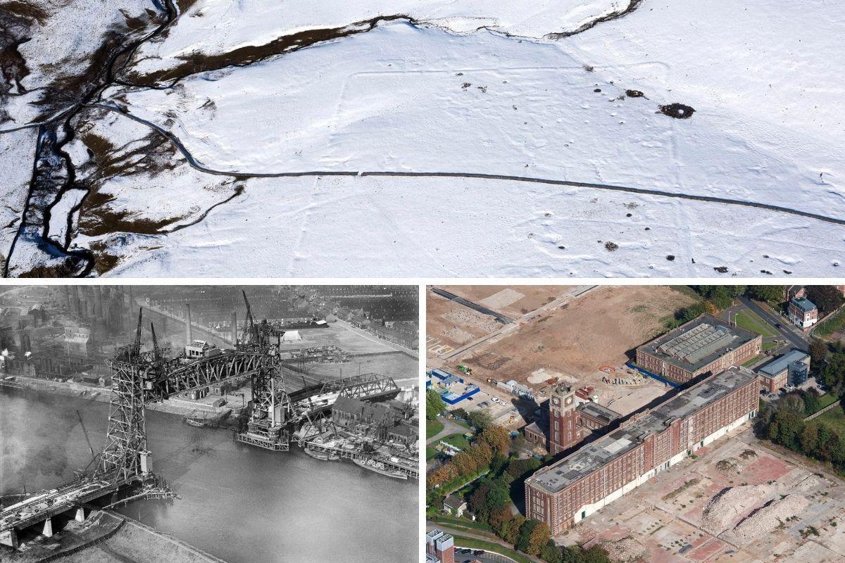
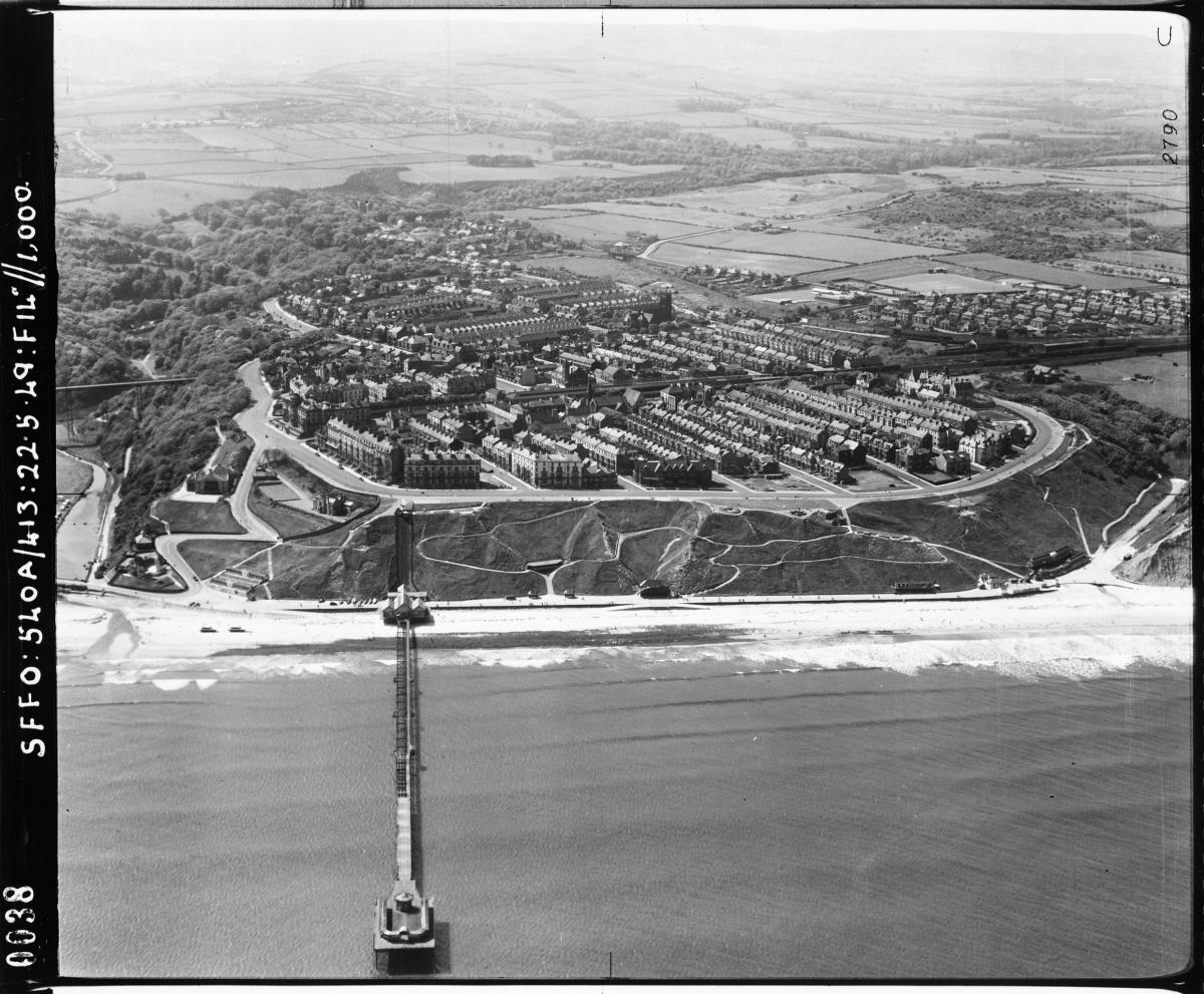
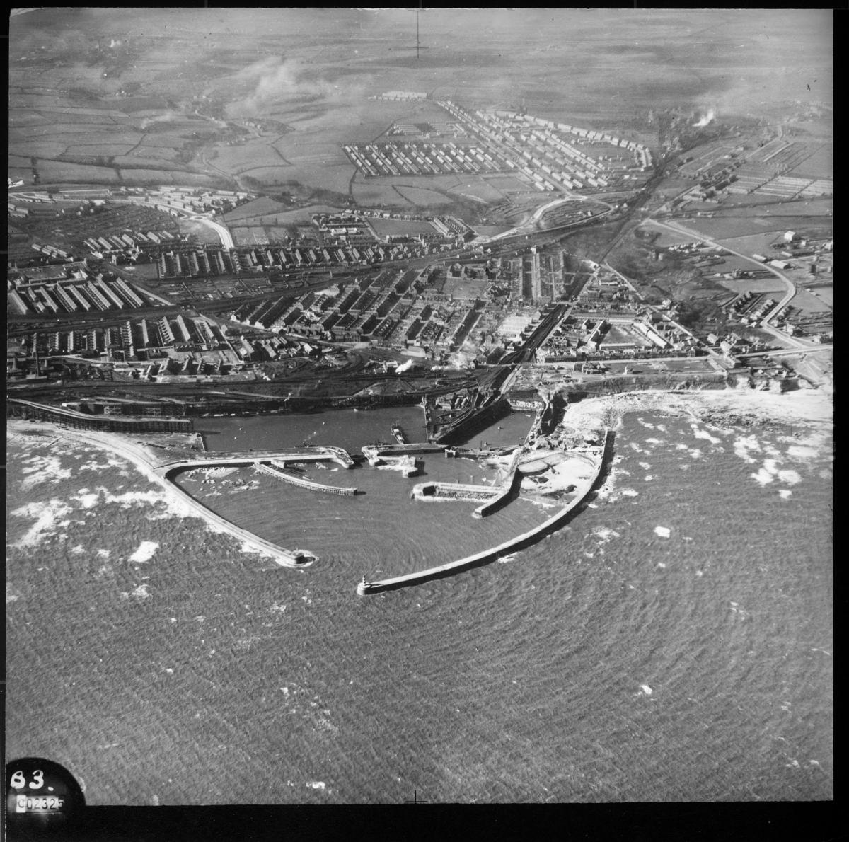
Images from the region include aerial photographs of St James’ Park Football Stadium in Newcastle taken in 1927, industrial heritage in Sunderland, Middlesbrough and York, and the coastline at Seaham Harbour in County Durham and Saltburn in North Yorkshire.
Aerial imagery provides a fascinating insight into the development and expansion of the nation’s urban centres and changes to the rural landscape.
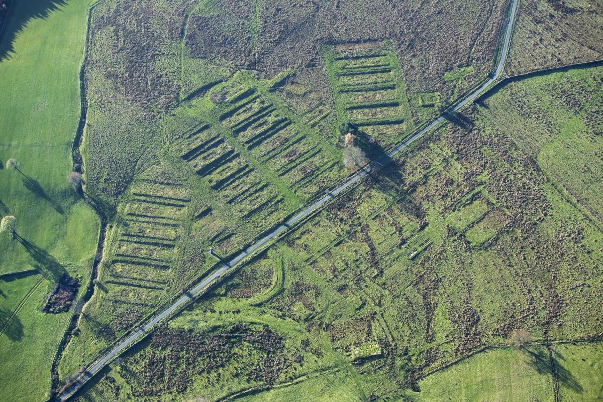
It can also reveal striking discoveries - such as ‘cropmarks’ showing hidden, archaeology beneath the surface.
By opening these images to the public through the accessible online tool, Historic England hopes to enable people to research their local areas, offering an insight into a century of changes and development.
The new Aerial Photography Explorer tool will also provide a useful resource for industry professionals and local authorities, to help with planning, heritage projects and archaeological investigation.

New imagery available online includes South Tyneside’s Souter Lighthouse, industrial heritage including Sunderland ship building in 1949, with a picture of the MV Andulo built by Bartram & Sons, and Middlesbrough’s Tees Newport Bridge, taken in 1933, a few months before it opened as well as the Terry’s Chocolate factory in York.
Coastal images include an aerial view of Saltburn from 1949 and Seaham Harbour, in County Durham, from 1941.
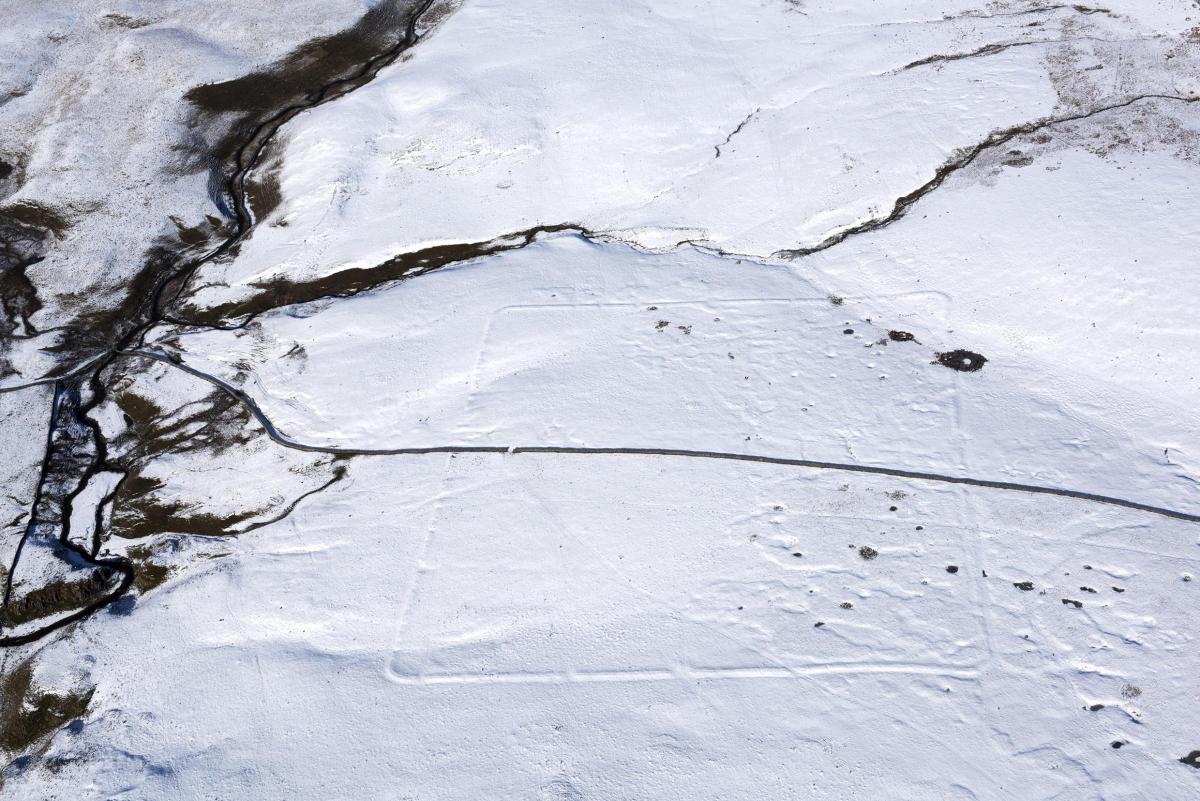
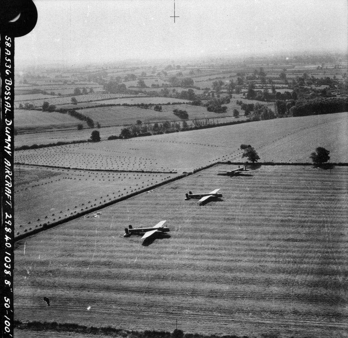
Second World War anti-invasion measures are also pictured, including an early warning radar station and decoy airfields with dummy aircraft in North Yorkshire.

In North Yorkshire Roman archaeology can be seen in the hills above Malham in the Yorkshire Dales, Second World War anti-invasion measures such as an early warning radar station in Bempton and a decoy airfield with dummy aircraft in Bossal.
In County Durham, there’s an image of Seaham Harbour from taken by an RAF reconnaissance aircraft in 1941.
Around 300,000 of the photographs are the work of Historic England’s Aerial Investigation and Mapping team.
Established in 1967, the team takes photographs of England from the air to discover new archaeological sites, create archaeological maps and monitor the condition of historic sites across the country.

The remaining 100,000 images come from the Historic England Archive aerial photography collection, which numbers over two million images in total, and includes important historic photography, including interwar and post-war images from Aerofilms Ltd and The Royal Air Force.
Duncan Wilson, chief executive of Historic England, said “I am delighted that our new online tool will allow people easy access to our wonderful collection of aerial images and to enjoy the historic photography that our team uses every day to unlock the mysteries of England’s past.”
Nigel Huddleston MP, Minister for Heritage said "What better way to discover our shared history than through this fascinating new online tool which offers a bird's eye view of our past.

"I can't wait to discover more about my local area and encourage everyone to explore the thousands of English sites from the last century."
Over the coming years, Historic England aims to expand the platform, as more of the six million aerial images in Historic England Archive are digitised.
The Aerial Photography Explorer joins Historic England’s recently launched Aerial Archaeology Mapping Explorer to offer an unparalleled insight into England’s archaeology and the nation’s development.
To search the platform, visit HistoricEngland.org.uk/AerialPhotos
Keep up to date with all the latest news on our website, or follow us on Facebook, Twitter and Instagram.
You can also follow our dedicated North Yorkshire Facebook page for all the latest in the area by clicking here.
For all the top news updates from right across the region straight to your inbox, sign up to our newsletter here.
Have you got a story for us? Contact our newsdesk on newsdesk@nne.co.uk or contact 01325 505054


Comments: Our rules
We want our comments to be a lively and valuable part of our community - a place where readers can debate and engage with the most important local issues. The ability to comment on our stories is a privilege, not a right, however, and that privilege may be withdrawn if it is abused or misused.
Please report any comments that break our rules.
Read the rules here