

ON MONDAY 1,946 years ago in what is now Seville in Spain, Publius Aelius Hadrianus was born. His name, of course, lives on here in the North East in the remarkable wall that he ordered should be built 1,900 years ago.
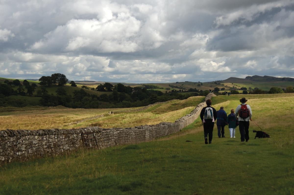
To commemorate the anniversary of Hadrian’s Wall, a year-long festival starts on the emperor’s birthday with events being held along the wall’s 73 mile length until the Roman feast of Saturnalia in December. It gives people in the region a chance to reconnect with an amazing piece of history and civil engineering which is right on their doorstep and to which practically all the roads through their communities lead.
Emperor Hadrian

HADRIAN (above) was the son of the senator, and Trajan, the emperor, was his first cousin. When Trajan died in 117, Hadrian succeeded him and became the 14th Emperor of Rome, ruling for 21 relatively peaceful years.
He reversed Rome’s policy of continual expansion and used natural boundaries to defend the vast territory from Iraq and Egypt in the south-east to somewhere near Eboracum (York) in the north-west. Where there weren’t rivers and seas to act as boundaries, he ordered walls should be built in Germany and north Africa.
In 122, Hadrian visited England, which the Romans had first invaded under Julius Caesar in 55BC. They had not managed to quell the Caledonians, so Hadrian ordered a wall should be built from coast to coast to separate the Romans from the barbarians.
The wall

Cuddy's Cragg near Housesteads
IT was 80 Roman miles long, running from Bowness-on-Solway in the west to Wallsend – which the Romans knew as Segedunum – on the River Tyne in the east.
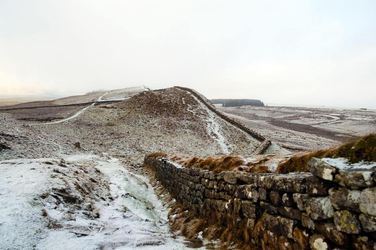
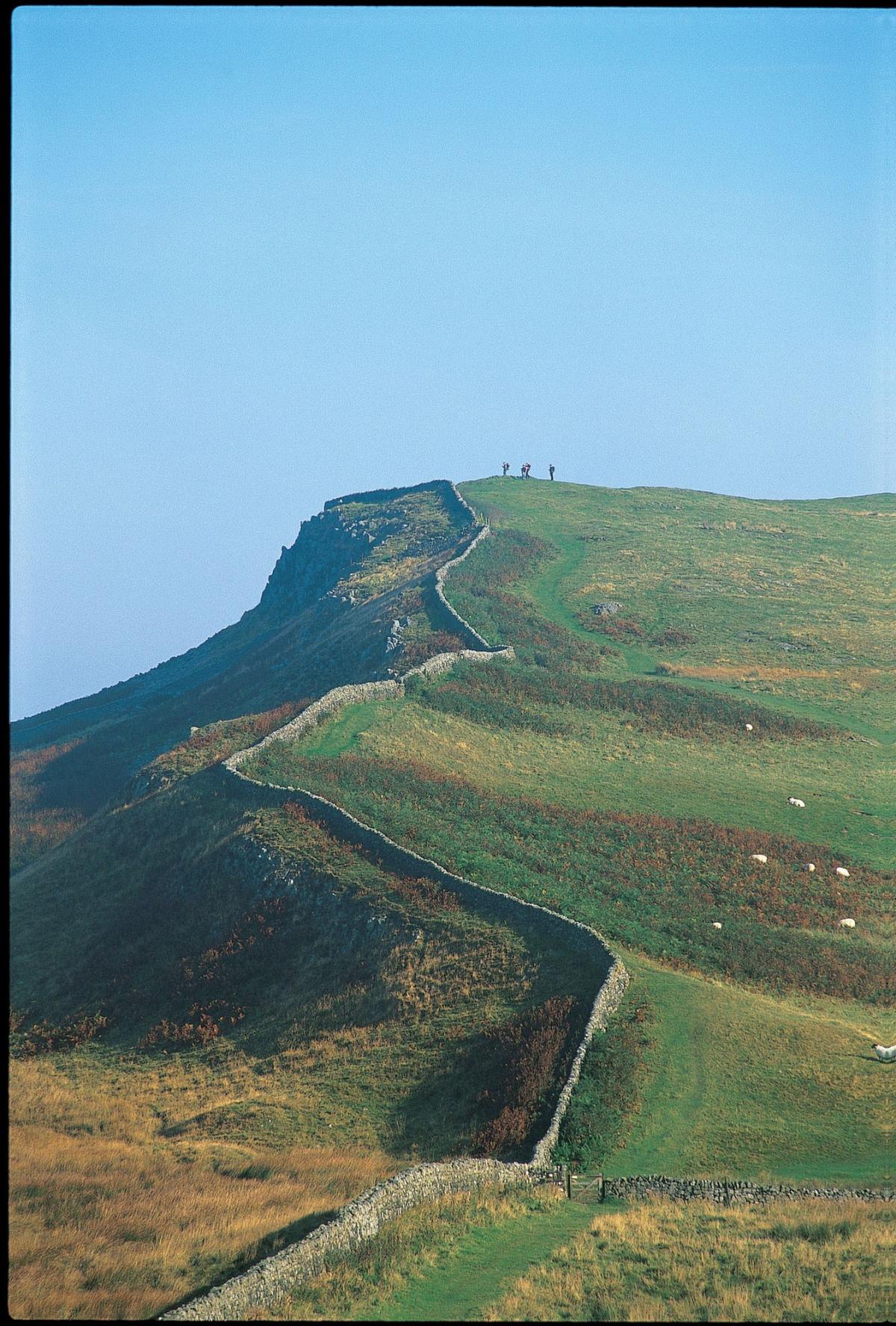
By the time Hadrian died in 138, all of it was built of stone held together with clay. It was 12ft high (or 15 Roman feet), and between 7½ft and 9½ft wide. It was surveyed to make best use of natural features, and so its dramatic central section follows a lofty ridge of the Whin Sill, an igneous rock which High Force tumbles over in the west and which the castles of Bamburgh and Holy Island are built on in the east.

Milecastle 39, also known as Castle Nick
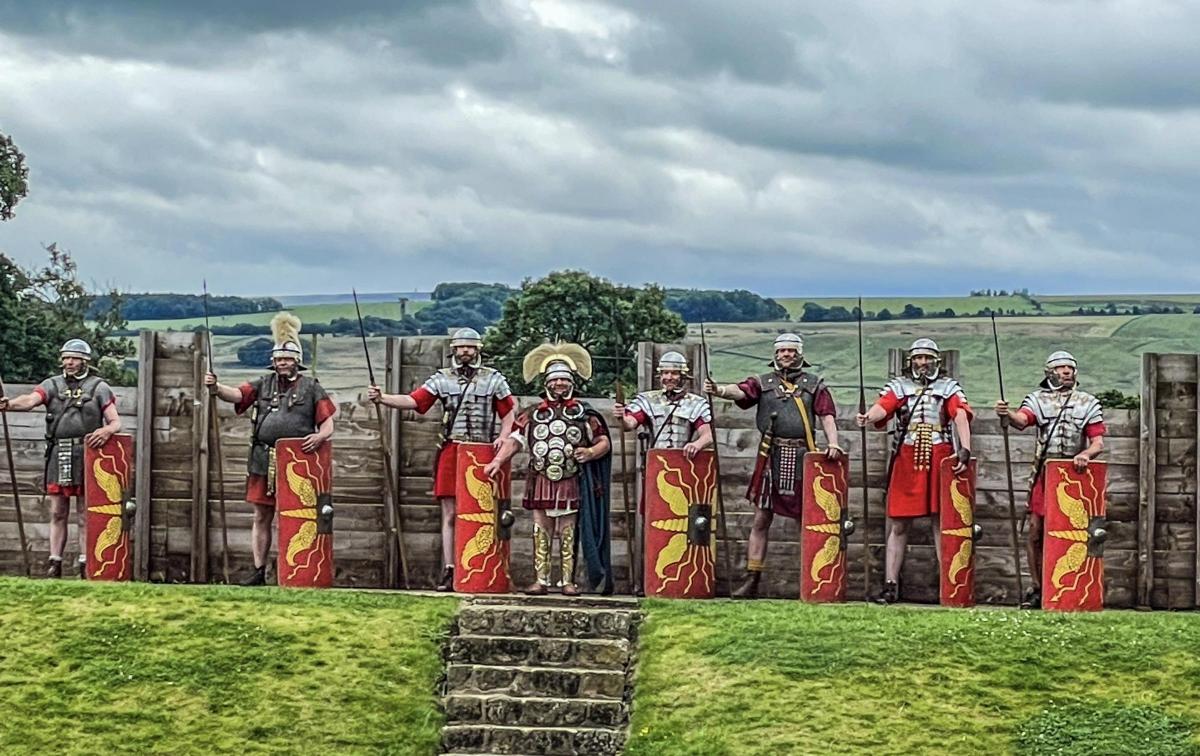
At each of the 80 miles there was a milecastle, which was a gatehouse that could hold between 12 and 20 soldiers. Spread between two milecastles were two observation turrets. Along the length of the line, there were 17 forts where up to 600 soldiers were based. These had bathhouses, latrines and hospitals, and usually civilian settlements grew around them.

Building the wall near Housesteads and Crag Lough when the Romans came under attack from the Caledonians
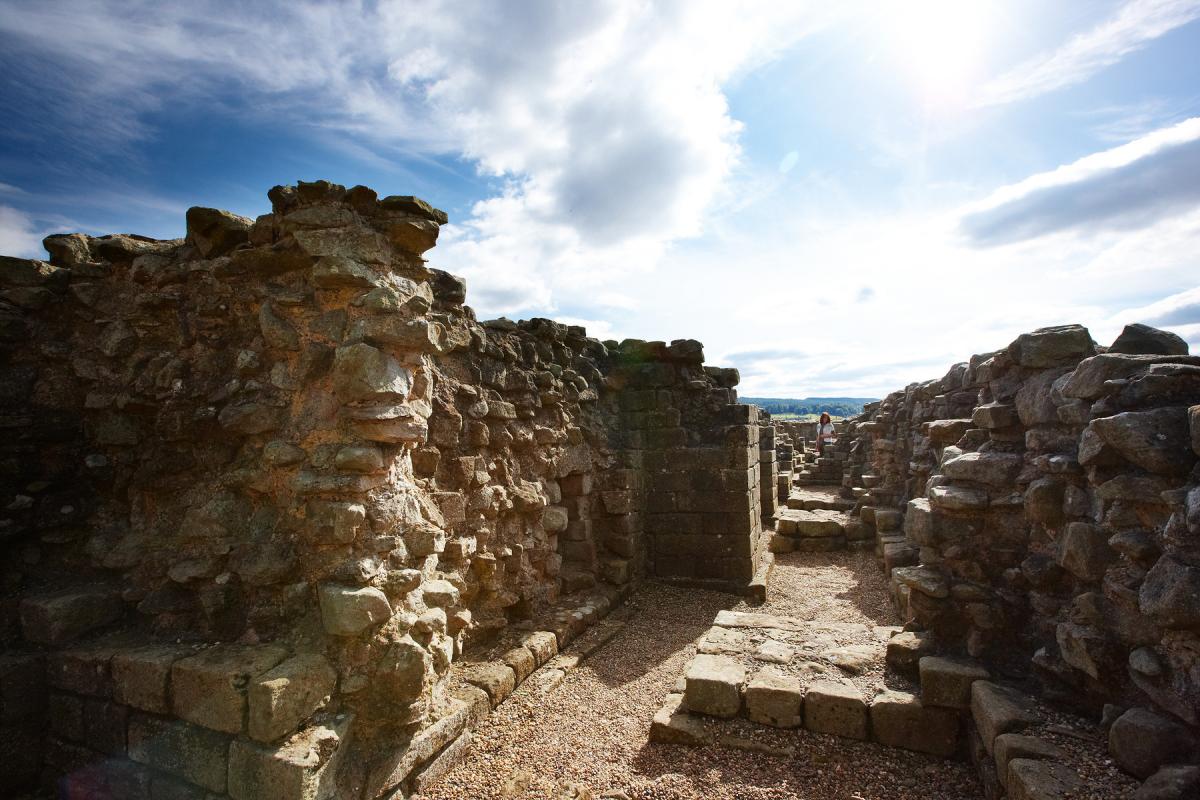
Among the best known forts are Birdoswald, Vindolanda, Housesteads and Chesters. all of which are open to the public. Housesteads, on its exposed crag, is perhaps the most photographed; Vindolanda has probably been the source of the most finds, from the murdered female child beneath its floor to the 2,000 wooden tablets which contained the earliest writing. The tablets include letters and lists and reports. One is an invitation to attend the birthday party of Claudia Severa, who was the wife of the commander of a nearby fort; another seems to be about military tactics in which the natives are referred to as “Brittunculi” – “nasty little Brits”; another mentions the price of beer.

A dog must have run across a row of tiles drying in the sun at Vindolanda, and its print was preserved forever. It was found in 2015 and goes with the 6,000 leather shoes - for humans - which have been found at Vindolanda. Pciture: P Trichler
To the north of the wall, a deep ditch was dug along with secret pits into which Scots with hostile intent might fall.
To the south of the wall, another ditch with ramparts was dug. A routeway ran along the ramparts connecting the line.
Three legions of infantrymen, each comprising 5,000 men, built the wall in just six years.
Why a wall?

IT kept unruly elements out, but also the number of milecastles – 80, although later reduced to about 16 so they could be manned – suggests it was to let people in, as long as they were under control and had paid whatever taxes they needed to. The incomers would be led to a market, allowed to sell their produce (as long as they paid more taxes) and then escorted out. Even in the 21st Century, trading boundaries are deeply contentious issues…
The wall may have been plastered and whitewashed. In days of mud and straw houses, it would have been a great psychological statement to the natives that they were in the presence of a mighty power.
Did it work?

HADRIAN’S successor, Antonius Pius, immediately abandoned the wall and tried to advance into Caledonia where, 100 miles north, he built a new wall – the Antonine Wall – of turf. It was the boundary for about 20 years, but in 162 the Romans retreated to Hadrian’s Wall.
Around 200, the barbarian tribes of Caledones and Maeatae sporadically attacked the wall, as did the Picts in the 4th Century, but the wall ensured the edge of empire was largely peaceful.
It had a profound effect on the wall’s hinterland in the North East where large forts were built on the roads leading to the wall. Dere Street ran from Catterick over the Tees at Piercebridge and onto Binchester, the largest Roman fort in County Durham near Bishop Auckland, through Ebchester to Corbridge; a second road, known as Cade’s Road, probably crossed the Tees at Middleton One Row and went through Sedgefield, where there is growing evidence of a large “motorway service station” town waiting to be discovered, and then to Chester-le-Street. The communities around those roads would have been trading with the passers-by and probably supplying the soldiers with food – there were 10,000 soldiers stationed along the wall.

The fall of the wall
THE Romans began to give up on Britain in 407. Many of the soldiers would have been British or from other parts of the continent, and when they didn’t get paid, they would have gone home or grabbed a bit of land and tried their hand at farming.
Over the centuries, the wall was a superb source of free stone and was plundered to build churches and houses – the Corbridge Vicar’s Pele tower which stands in the churchyard overlooking the town centre was built in 1328 with stone from the nearby fort.

Milecastle at Cawfields Craggs, by Roger Clegg
The biggest damage to the wall was done in the 1750s by road-builders. When Bonnie Prince Charlie had threatened in 1745, General George Wade had found it took him a week to move his army from Newcastle to Carlisle because of the conditions underfoot, and so a straight road was constructed, partly on top of the ditch beside the wall and using a lot of stolen stone for foundations. On the plus side, the Military Road is now the B6318 and it means that the wall is accessible even to those who don’t want to spend days hiking along it.
In the 1830s, antiquarian John Clayton, a Newcastle lawyer was so concerned about the deterioration of the wall that he began buying as much land around it as possible. Although his descendants lost his estate through gambling, the National Trust was later able to get it back so the wall is now largely in public ownership. Clayton’s collection of artefacts is on display at Chesters fort.
1,900th anniversary

LATE last year, National Geographic magazine said that, alongside Mozambique, Ecuador and the Danube, Hadrian’s Wall was one of its 35 must-see places in the world in 2022.
Emperor Hadrian’s birthday is celebrated on Monday with the launch of new exhibition, Obscurum Lux at Wallsend, a bunting competition at Vindolanda, a virtual guided walk and an archaeological conference at Newcastle university. There are events throughout the year at most of the region’s Roman sites. Go to 1900.hadrianswallcountry.co.uk for a full list and more details or, alternatively, go for a free walk in the beautiful Northumberland countryside – but check the weather forecast first.

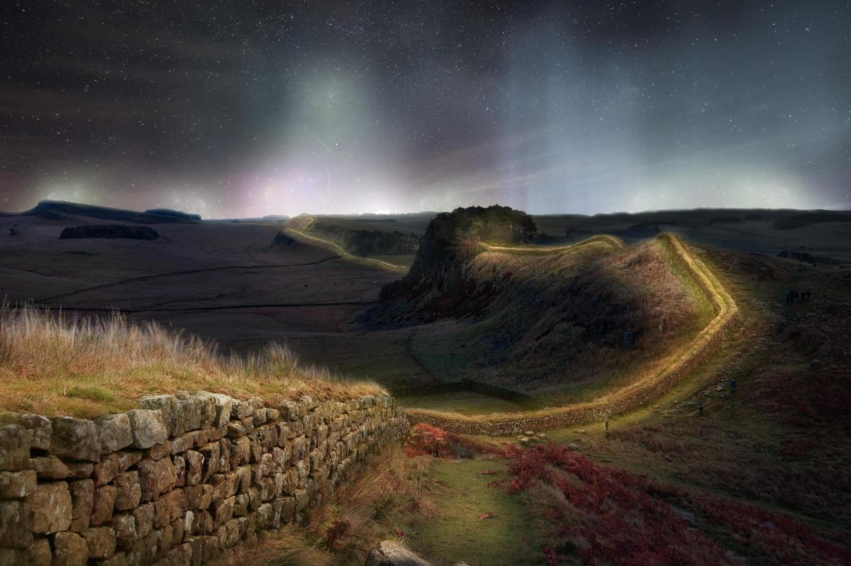
Sycamore Gap is perhaps the most famous spot along Hadrian's Wall. There are several "gaps", or dips, in the wall, formed by meltwater running from ice sheets during the last Ice Age. The name, Sycamore Gap, has only come about in recent decades. The tree - the 2016 English Tree of the Year - has featured in the film Robin Hood Prince of Thieves and in ITV's Vera.
Below: The Northern Lights are illuminating the famous tree. Picture: Owen Humphreys


Comments: Our rules
We want our comments to be a lively and valuable part of our community - a place where readers can debate and engage with the most important local issues. The ability to comment on our stories is a privilege, not a right, however, and that privilege may be withdrawn if it is abused or misused.
Please report any comments that break our rules.
Read the rules hereLast Updated:
Report this comment Cancel