


MEMORIES 515 featured a selection of pictures showing the construction of the A1 around Darlington in the first half of the 1960s.
One of our pictures showed a steam engine crossing a newly-built bridge beneath was a muddy track where the lanes of cars would soon go. The caption on the rear said simply “Coatham Mundeville” – could anyone, we asked, be more precise.

A 1991 picture by Ray Goad showing a Pacer crossing the bridge to the north of Darlington. Picture: JW Armstrong Trust
And, of course, you could. Loads of people spent the weekend studying maps and working out exactly where we were.
We were in fairyland…
“The photo shows a steam hauled freight train crossing the A1M on a single line stretch of the Darlington to Shildon to Bishop Auckland line, about a mile south of Heighington station,” said Rodger Darbyshire, of Darlington, echoing the thoughts of an army of correspondents.

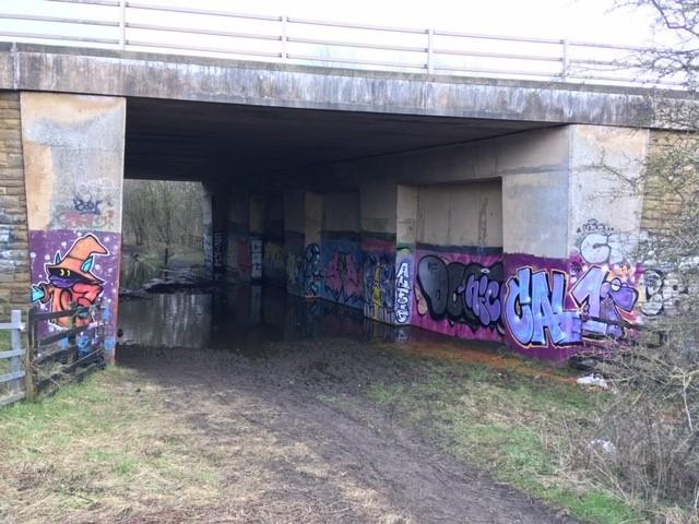
The bridge that the Barnard Castle branchline used beneath the A1 for just six months
“The bridge is about a mile west of Coatham Mundeville, and the photo was taken from a farm bridge which is only about 50 yards north of the railway bridge.
“Therefore, the train is travelling towards Shildon.
“Today, both bridges are about a mile south of the Aycliffe Interchange, junction 59.”
An exemplary answer.
Alan Orchard added: “The bridge is still in existence and unchanged but would benefit from a lick of paint!”

Stag House Farm, which was demolished in 2018
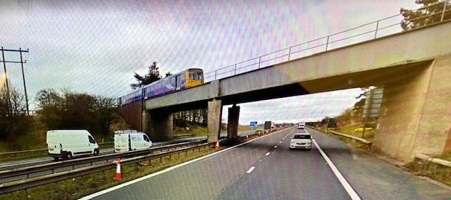
Loads of people pointed out that if you look at the bridge from a certain angle on Google StreetView, a hated Pacer train is on it, almost replicating our original picture on which, said David Sayer of Norton, was a Class J steam engine.
“Interestingly,” said Tony Allen, “this is the exact route taken by Locomotion No 1 on September 27, 1825.”
He is correct. This is the trackbed of the Stockton & Darlington Railway.
More than that. As Richard Barber pointed out, this area is known as Myers Flat, which, in 1825, was a “swampy tract”.
In fact, for George Stephenson, Myers Flat was the most awkward part of the 26 mile line. His tactic to overcome the swamp was to tip hundreds of tons of earth into it and tamp it down so it looked like a railway embankment. Next morning, the navvies would return to work only to find all of their soil had disappeared.
Had it seeped overnight into the bog, or were the fairies from nearby Middridge Hill – a centuries old residence of theirs – stolen it away?
Local people said was haunted by strange spirits called Will o’Wisp and Jenny o’t’Lantern. It was, they said, a place where “t’fairies danced”.
So difficult was Myers Flat to conquer that John Potts, who farmed a few fields away at Dene Head (which still stands), would come down to taunt the railway constructors. He hated the railway and regularly predicted it would result in the bankruptcy of the Pease and Backhouse families promoting it.

The Bishop line bridge as seen on Google StreetView
At Myers Flat, he would shout to the workers: “Get thee away hame, all t’Darlington Quakers’ll be broken before that battery’s made.”
Eventually, though, the embankment was made and the line was open – although this stretch was notoriously unstable for years, with rails slipping down the sides as the swamp had the last laugh.
Or was it the fairies?
Many thanks to all who got in touch, including Andy Walker, Trevor Horner, Geoff Tinkler, John Heslop, David Walsh, Michael Young, David Pickup, David Sayer, Richard Stone, Dave Middlemas and Ian Hillary.
ANDREW BOWER and John Wilson have been tracing the route of the Barnard Castle branchline as it exited Darlington on its west side.
It left the Bishop Auckland line on the west of Rise Carr and headed due west over West Auckland Road (the bridge parapets can still be seen), under Nickstream Lane, over Newton Lane and then followed a straight line to the north of what is today Jedburgh Drive. The trackbed is what separates Jedburgh Drive from the new Stag House Farm estate.
At the west end of Jedburgh Drive, the Merrybent railway curved south. Of course, the A1(M) follows its path today.
When the motorway was built, a bridge at the end of Jedburgh Drive took it over the Barnard Castle branchline. The motorway opened on May 15, 1965, and the branchline closed to passengers on November 30, 1965, so the bridge had an operational life of just six-and-a-half months.

Our original picture of the steam train on the Bishop line going over the A1 north of Darlington
Still now, as Andrew’s picture shows, it is prettily adorned.
THE Stag House Farm estate is a development of 465 houses, although with the neighbouring development at Mount Pleasant Farm, a total of 1,200 new houses are being built.
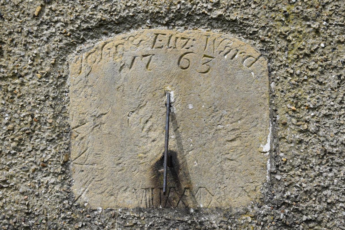
This meant the demolition in 2018 of the derelict Stag House farmhouse. It was examined and recorded by Archaeological Services at Durham university, whose report concluded that there was nothing of historical merit except an extremely long hinge on an outhouse door and the sundial on the front.
The weathered sundial was dated 1763, which was presumably when Stag House Farm was built, and bore the names of the couple who presumably built it: John and Elizabeth Ward.
It seems not to have been salvaged.
L Does anyone have any stories to tell about Stag House Farm?


Comments: Our rules
We want our comments to be a lively and valuable part of our community - a place where readers can debate and engage with the most important local issues. The ability to comment on our stories is a privilege, not a right, however, and that privilege may be withdrawn if it is abused or misused.
Please report any comments that break our rules.
Read the rules hereLast Updated:
Report this comment Cancel