
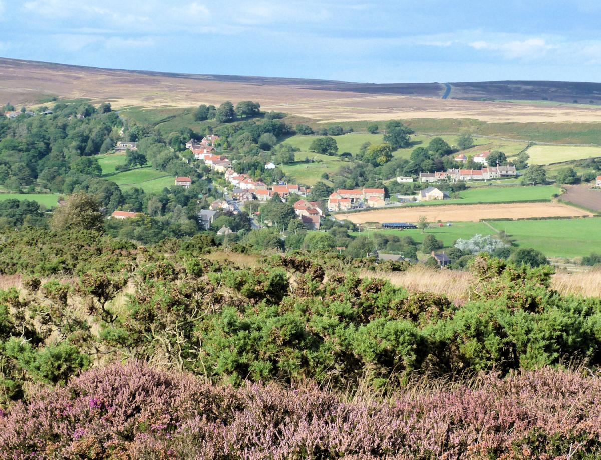
THE North York Moors have their own ‘dales’, quieter and ripe for exploration. The Fry ups (Great and Little) are two such with a base in the pretty village of Danby. I first noticed them whilst crossing the Coast and Coast to the south.
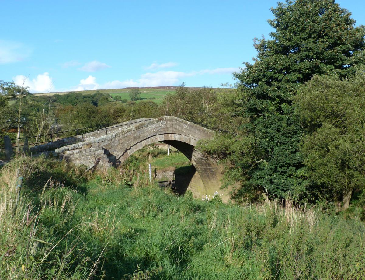
Danby lies in the Esk Valley and if you do not wish to drive has a train station. Only ½ a mile away is the impressive National Park Centre, located in an old shooting lodge which belonged to the Danby Estate. However the walk starts by heading south on the main road, crossing the River Esk and leaving to the east via a minor (and barely used) road for 1 ½ miles. The walking here is very pleasant and enlivened by an excellent example of a packhorse bridge midway where the road splits. Named Duck Bridge after George Duck of Danby who rebuilt the original medieval bridge in 1771 it is very impressive. Before crossing the bridge it is worth following the road south for 400 metres uphill to the remains of Danby Castle, the home of Catherine Parr, Henry VIIIs final wife. Return to cross Duck Bridge.
A further ¾ a mile from Duck Bridge the road splits again, take the right fork and after 100 metres the bridlepath heading up hill on to ‘The Heads’. After 200 metres the bridlepath splits in some woodland but keep ahead, through a disused quarry before it double back, still climbing, which leaves the woodland below you. Having past the farm walk to the next gate and instead of carrying on above the woods take the path heading on the ground straight up the hillside and the broad shoulder of the Heads. The views across the various moors and dales are superb from the shoulder. Wander off the path (it is access land) to look down Great Fryup dale before returning to the path and following it off the south end of the shoulder.
At this stage the path drops steeply for a short before entering some forestry and turning right in to the head of Little Fryup dale. Running parallel to Great Fryup it really is a little sibling, smaller and higher to its neighbour to the east. Where the footpath meets a minor road turn right and follow it across the head of Little Fryup and take to the footpath heading directly uphill when the road bends sharply right after ½ a mile. This path heads west and after a short, steep climb emerges at the Trig Point of Danby Rigg, set high on a second broad shoulder.
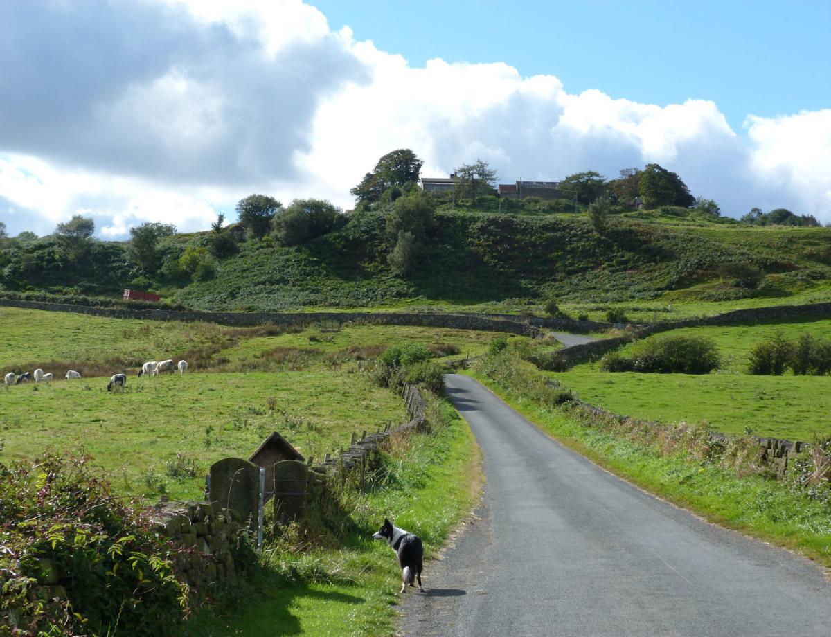
Leave the path at the trig and head along the shoulder for 400 metres till meeting a bridlepath heading just west of north. Again the views are impressive as the path starts to drop towards Danby. The path drops past a Standing Stone and some archaeological remains before meeting a quiet road. Before reaching Danby the road passes through the settlement of Ainthorpe with its hotel, you may be tempted to stop but if not there is a second one in Danby.
Jonathan Smith runs Where2walk, an outdoor business in the Yorkshire Dales. He has written his own book, the Dales 30, which describes the highest mountains in the Dales. He also runs one-day navigation courses for beginners and intermediates, and learn a skill, climb a hill weekends. To find out more details on any of the above and details of many more walks in the area visit where2walk.co.uk

WALK FACTS
Distance: Roughly 8 miles (13km).
Height to Climb: 400m (1,310 feet)
Start: NZ 708087. There is plenty of places to park in this small village.
Difficulty: Medium/Hard. The walk is along a mix of quiet roads/lanes and good footpaths.
Refreshments: There is an excellent pub and café in Danby.
Be Prepared: The route description and sketch map only provide a guide to the walk. You must take out and be able to read a map (O/S Explorer OL27) and in cloudy/misty conditions a compass (essential on this walk). You must also wear the correct clothing and footwear for the outdoors. Whilst every effort is made to provide accurate information, walkers head out at their own risk.
Please observe the Countryside Code and park sensibly.


Comments: Our rules
We want our comments to be a lively and valuable part of our community - a place where readers can debate and engage with the most important local issues. The ability to comment on our stories is a privilege, not a right, however, and that privilege may be withdrawn if it is abused or misused.
Please report any comments that break our rules.
Read the rules here