
THIS is one of my favourite walks in the North York Moors. Contrasting the lovely woodland walking alongside the iconic railway line (listen out for the steam trains) with some airy moorland scenery brings together much of the areas characteristics.
You can start at either Goathland or Grosmont but I prefer Goathland for its range of places to explore and eat in after the walk. From the car park next to the information head north along a road for 200 metres to a footpath sign on your left for the Rail Trail. The 2.5 miles to Grosmont along the old cinder railway track (the original built in 1836 was initially used for horse drawn carriages) is almost entirely downhill and a great way of loosening the legs for the tougher parts to come.
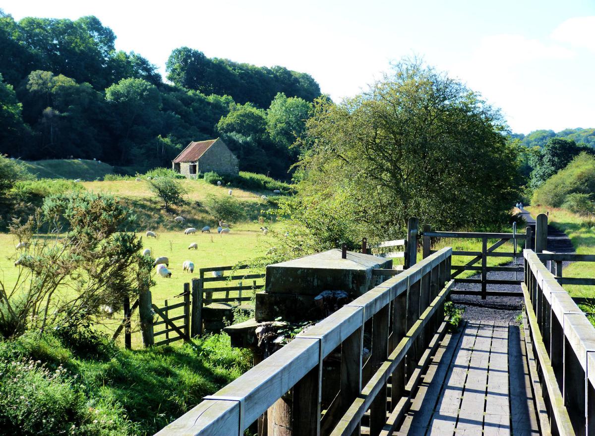
The path passes through some lovely mixed woodland, alongside a pretty stream with various nods to the original railway line (the new one lies to your right, higher up and is only seen towards the end of the Rail Trail).
After the first mile a track to your right leads into the small hamlet of Beck Hole, the pub is possibly the smallest you have ever seen but offers a nice gateway to nearby Thomason Foss, a pretty waterfall.
As the trail gets closer to Grosmont, it is met at some old railway houses by the new track. Next to the track is an old engine house with some rusted old trains, a fascination for those with an interest in the line. The path climbs a little near the engine shed before dropping down in the the pretty village of Grosmont.
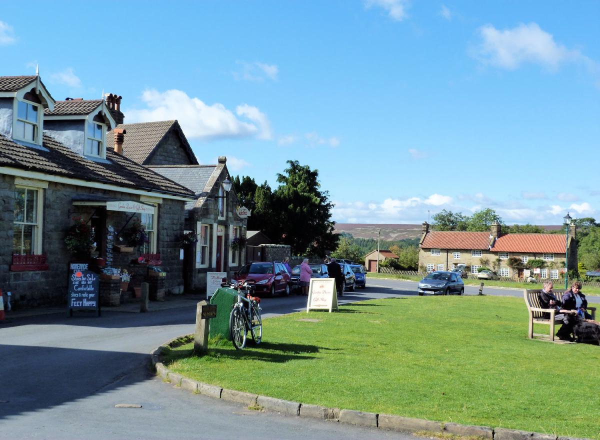
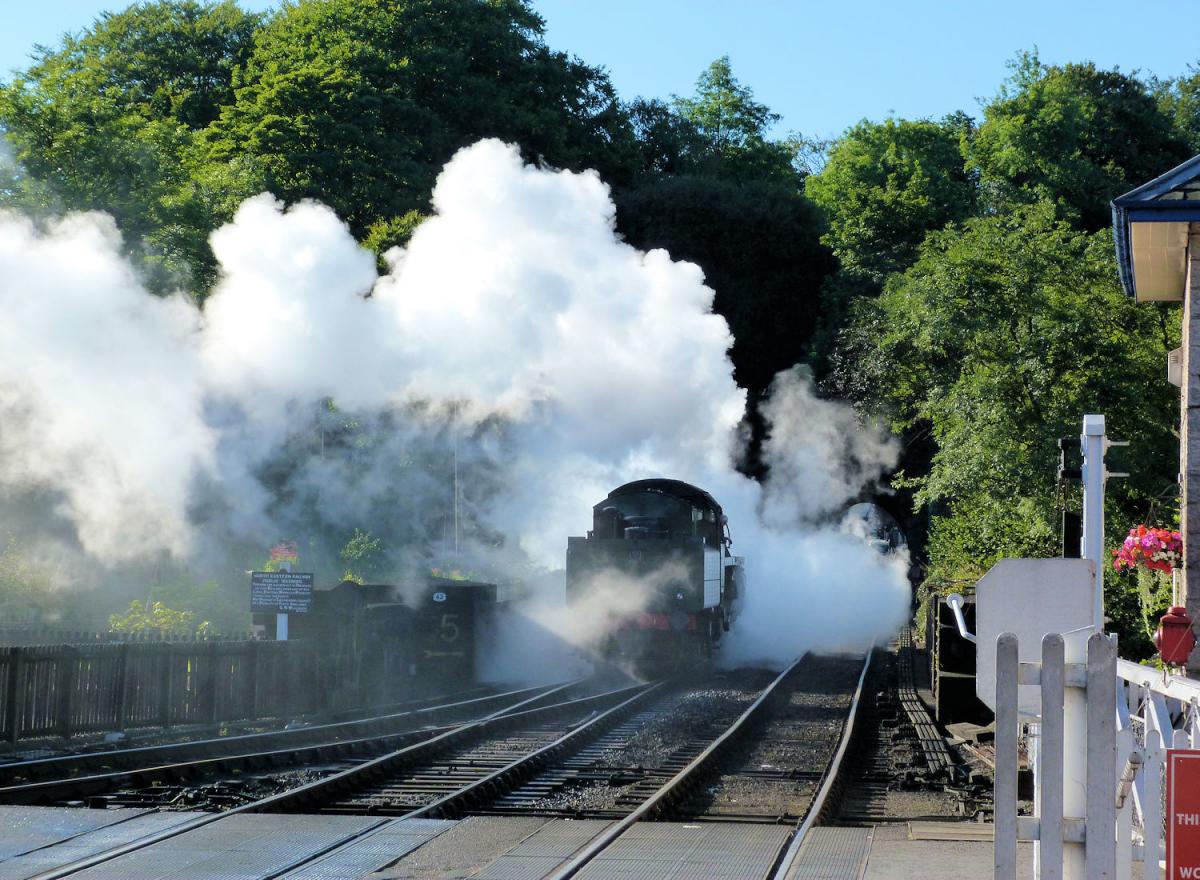
Peaceful now, the village grew up in the early 19th century after the discovery of iron in the nearby hillside. The railway dominates the village, Grosmont being the junction of the commercial Esk Valley railway to Teesside and the heritage line from Pickering to Whitby. The heritage line runs volunteer staffed steam trains throughout the year and when one is in (they run roughly every two hours) it is a great site. It is worth having a cup of tea at the station if a train is due.
Cross the rail tracks and head steeply up the Whitby road. After 300 metres take the right fork on to a quieter road and continue climbing. The views open up brilliantly up here towards the sea and the north. It is also part of the Coast to Coast walk, for many long distance walkers the final climb of a near 200-mile trek! After one mile the road splits as it enters some high moorland. A footpath to your right heads south over the moors. This is the next stage of the walk.
For half a mile, the path sticks near a wall before dropping steeply in to a small river gully. The 200-foot climb brings you to a farm/holiday cottage complex at Greenlands, a good example of a farm diversifying and changing in difficult farming conditions. The path circles around to the west of little Arundel Hill before heading across open moorland. It is a fine panorama and typical of much of North York Moors walking with great views in all directions including the military base at Fylingdales.
After crossing a road, the path drops down towards the small community at Darnholm. Rather than cross the river keep to the path to the east of the railway for a further half mile until it arrives at Goathland Station, a site used in many films, including as Hogwarts in the Harry Potter films. Cross the train line over the bridge and climb back to the centre of the village passing the garage used for the filming of Heartbeat on your right.
* Jonathan Smith runs Where2walk, an outdoor business in the Yorkshire Dales. He has written his own book, the Dales 30, which describes the highest mountains in the Dales. He also runs one-day navigation courses for beginners and intermediates, and learn a skill, climb a hill weekends. To find out more details on any of the above and details of many more walks in the area visit where2walk.co.uk.

WALK FACTS
Distance: About 7.5 miles.
Height to climb: 410m (1,345 feet).
Start: NZ 836014. There is parking with toilets in the centre of Goathland.
Difficulty: Medium/hard: The Rail Trail is very easy but it is a steep climb up on to the moors which can be a bit wild in bad weather. The walk can be made easy by just taking the Rail Trail and returning by train to Goathland.
Refreshments: Goathland has a choice of cafes and pubs.
Be Prepared: The route description and sketch map only provide a guide to the walk. You must take out and be able to read a map (O/S Explorer OL27) and in cloudy/misty conditions a compass (essential on this walk). You must also wear the correct clothing and footwear for the outdoors. While every effort is made to provide accurate information, walkers head out at their own risk.
Please observe the Countryside Code and park sensibly.


Comments: Our rules
We want our comments to be a lively and valuable part of our community - a place where readers can debate and engage with the most important local issues. The ability to comment on our stories is a privilege, not a right, however, and that privilege may be withdrawn if it is abused or misused.
Please report any comments that break our rules.
Read the rules here