

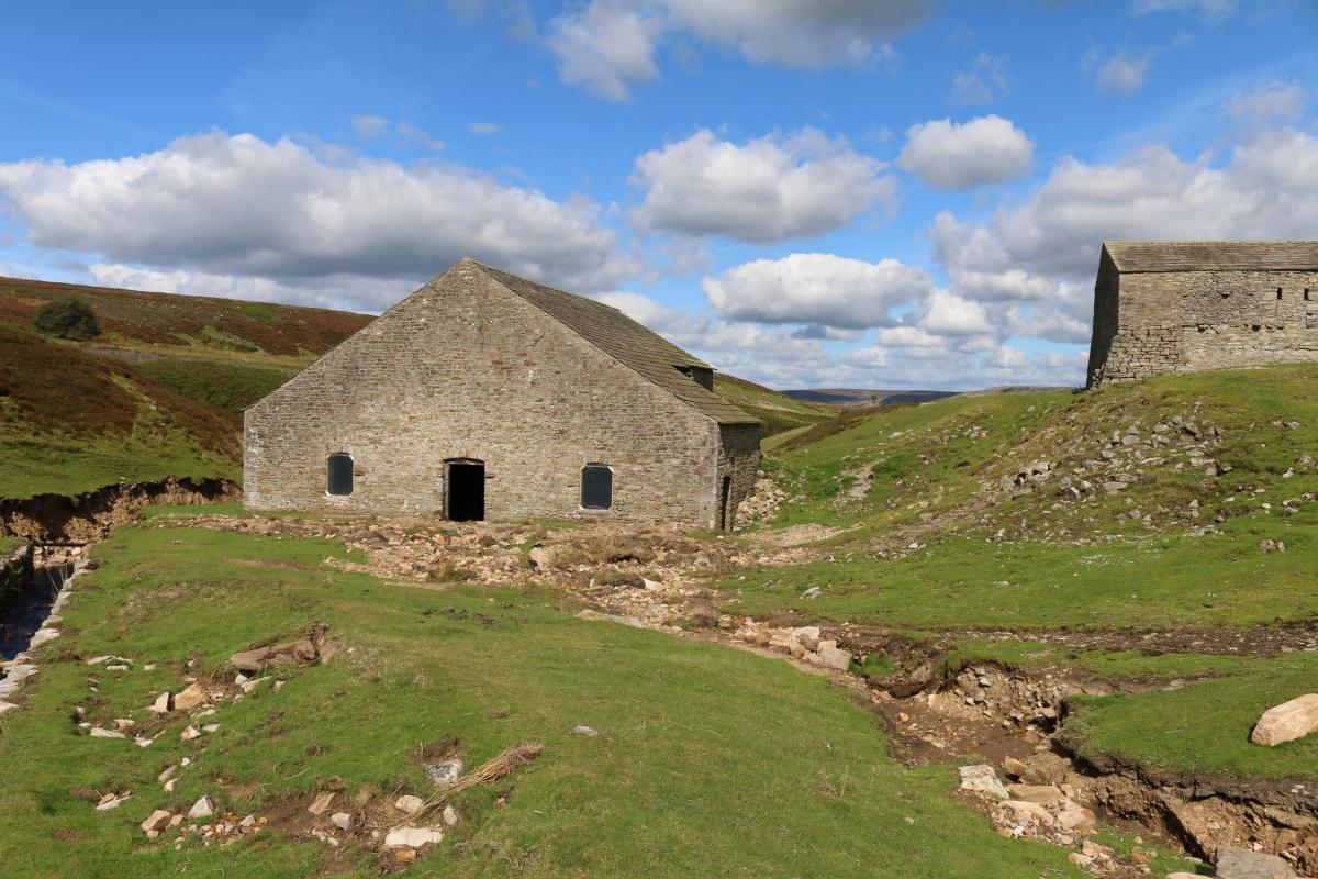
IT is hard to imagine the power of the water that was unleashed by a stormcloud over Swaledale on July 30, but it has left the best preserved leadmining smelt mill in the Yorkshire Dales at risk of joining the “at risk” register.
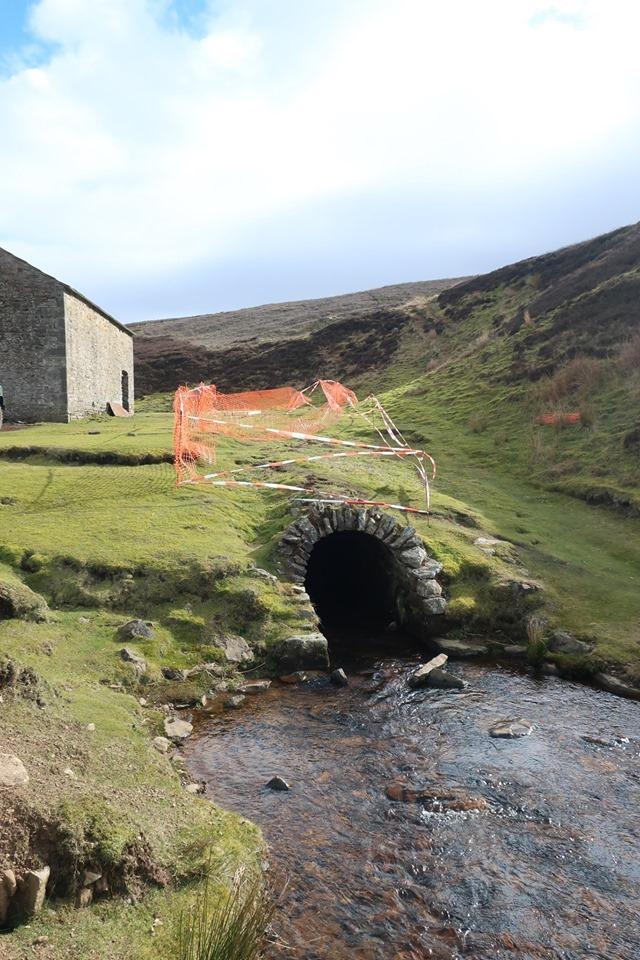
As Memories 439 told, Grinton smelt mill dates from 1820. It is on the south side of the dale, just above the Tour de France bridge over Cogden Beck, which was washed away. The site consists of a mill building which contains evidence of a giant waterwheel, an arched peat store, and a 290 metre flue which runs up the side of the dale.
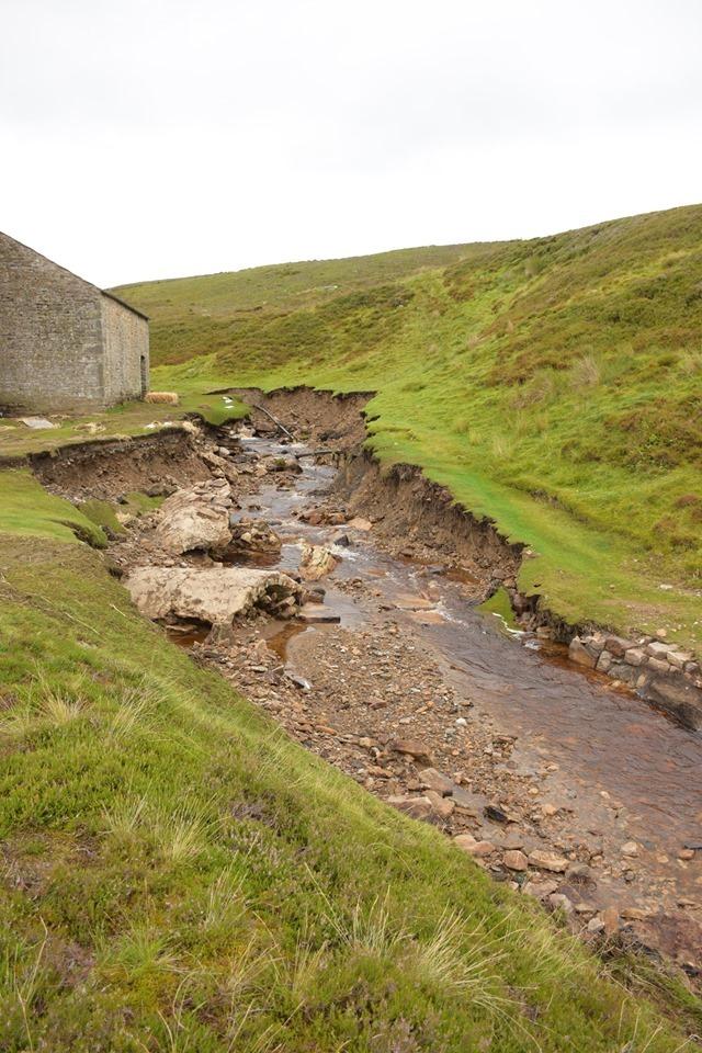
Until the July 30 flood, on the west side of the mill building there was also a 40 metre covered culvert, covered in turf, which was a listed building in its own right. But the whole culvert has been washed away, leaving the Cogden Beck with unsupported sides – the turf now flows off the stable ground and down the beckside like a green waterfall.
“The culvert was built for access from one side of the beck to the other and to provide a safe working area for the smelters who would have been taking waste slags and tipping them close to the watercourse,” says Miles Johnson, senior historic environment officer at the Yorkshire Dales National Park. “The culvert also stopped the watercourse from moving and now it has gone, every time there’s heavy rain, there’s a risk of the building itself being undercut because in places it is very close to the smelt mill.
“Historic England are currently considering its inclusion on the at risk register – my view is that it does put the smelt mill at risk.
“It is an important site as it is the most complete smeltmill in the Yorkshire Dales, and so we are going to try to do emergency works to armour the side of the watercourse.”
The leadsmelters 200 years ago created a dam and a reservoir just above the mill so that the water gushed along a “launder” (a rather wobbly-looking wooden aqueduct) and entered the mill building at roof height.
The water poured out of the launder onto the waterwheel which turned to pump the bellows which enabled the peat furnaces to reach more than 1,000 degrees. This enabled molten lead to be extracted from the stone.
Cogden Beck was effectively the overflow from the leadsmelters’ reservoir, but on July 30, the beck wreaked the ultimate revenge on the men who had tried to shape its course. It tore down the culvert which fell and initially blocked its course, causing the water to back-up a couple of feet in the mill itself.
When the temporary blockage gave way, the beck burst through with such force that it broke down Cogden bridge and then carried centuries of industrial waste down to the riverside paddocks, leaving the fields contaminated.
“It is a site we are very concerned about, but hopefully we will soon get a project set up to prevent further damage,” says Miles. “Then there’s a bigger clean up job which will take a year or two.”
A temporary bridge has been erected on Grinton Moor over Cogden Beck so in beautiful weather at the weekend, there was a steady trickle of walkers and cyclists visiting the mill site to look in awe at the power of the storm.
It also enabled us to climb higher up the daleside where there is a roadside boundary stone, currently partially obscured by a speed limit sign warning of the temporary bridge.

According to the Ordnance Survey map, there is a line of these boundary stones that marches up the dale from the River Swale to its top at Snowden Man. We presume these are turbary stones.
A turbary was an area in which a group of tenants was allowed to cut peat, either for roofing or for fuel. As peat was the main fuel in the dales, woe betide them if they strayed over the boundary into another man’s turbary.

The stone has initials on it – ED. If anyone can tell us anymore about it, like who was ED, or if you have visited any of the more remote stones in the line, please email chris.lloyd@nne.co.uk


Comments: Our rules
We want our comments to be a lively and valuable part of our community - a place where readers can debate and engage with the most important local issues. The ability to comment on our stories is a privilege, not a right, however, and that privilege may be withdrawn if it is abused or misused.
Please report any comments that break our rules.
Read the rules here