


MORE than 20 natural features have been constructed to bolster flood protection in the a County Durham dale as part of a pioneering project.
The £2.1million government-funded Weardale Natural Flood Management scheme, which includes a series of nature-based solutions such as storage areas, wooden leaky barriers and timber fences, could reduce flood risk across 41 sq km to communities, including Lanehead, Wearhead, Westgate and Stanhope.
It’s also seen 150 hectares of peatland restored, will aim to create up to 75 hectares of woodland and brings a habitat boost to wildlife.

The project is led by the Environment Agency working in partnership with Natural England, North Pennines AONB Partnership, the Forestry Commission and Durham County Council with representation from the Wear Catchment Partnership, alongside local farmers and landowners.
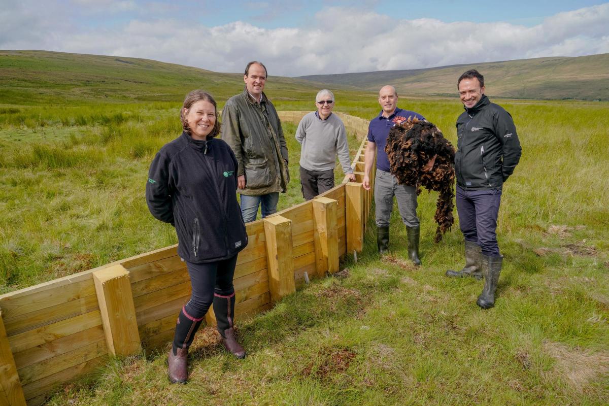
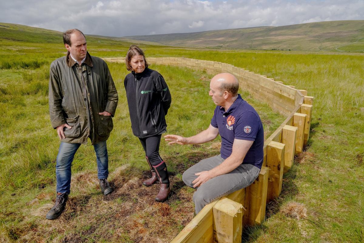
North West Durham MP Richard Holden visited the site on Thursday to find out more about the project.
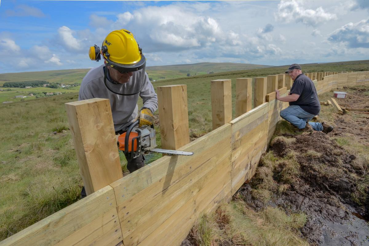
The first set of features were completed by two landowners this summer on the Middlehope and Killhope Burns, with the next phase due to start in September. In total, they have the potential to store up to 5,150m3 of water – the capacity of more than two Olympic sized swimming pools.
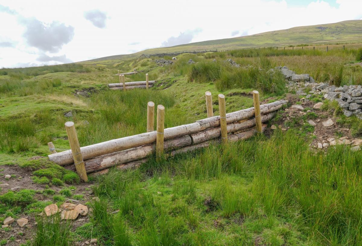
At Killhope Burn, 13 leaky dams have been built across the burn to restrict the flow of water and four timber fences constructed to slow the movement of water across the landscape
At Middlehope Burn four storage areas have been created which will hold back water during heavy rain. By October, four more storage areas will be created.
Further features will be built into the landscape next year as the project continues. The work explores reducing flood risk using natural flood management techniques to communities which have historically flooded due to water running from the surrounding hills.
Kirsty Hardy, Environment Agency Project Manager, said: "Our innovative approach, which has included flood risk modelling and working with communities to understand the flood history and landscape, has helped us identify the locations that provide the greatest benefit to reduce flood risk.
“Landowners and farmers and their skills and local knowledge are integral to the project’s ongoing success and our commitment to all working together has ensured our vision is coming to life.

“Not only is this protecting local communities, it’s bringing so many positive benefits for climate regulation, wildlife, water quality, water resources and amenity.”
Landowner Greg Dalton, who led on the construction of the features, added: “We have enjoyed working collaboratively with the Environment Agency and hopefully these installations will mitigate flooding for the community and businesses downstream for many years to come.
“I am also hopeful that this will form part of the government’s future support schemes for farming, and farmers will be rewarded for helping address the pertinent issues arising from climate change.
“We have used local contractors and suppliers to ensure all installations are in keeping with the local landscape as well as supporting local businesses.”
Mr Holden said: “The better our flood management systems, the better we can protect our towns and villages across Weardale from life-changing harm.
“I was really pleased to hear from local farmer Greg Dalton and Kirsty and the Environment Agency team. When it comes to natural flood management it seems to me it’s best to work with the landowner from the start. It was great to see that Greg’s ideas were taken on and implemented by Kirsty and the Agency.
“From what I have seen today natural flood management could change the way we manage floods and how the Environment Agency work with landowners to understand what works best on their land and for the local towns and villages.”
The latest work follows a demonstrator site which was completed in August 2019 and which stored 400m3 of flood water to protect communities from the impact of Storm Ciara in February 2020. A citizen science programme will monitor the features and feed into a range of projects to better understand flood risk management on a catchment scale.
Sarah Tooze, Biodiversity Lead from the North Pennines AONB Partnership, added: “The AONB Partnership’s role in this project has been to lead the engagement with farmers and landowners, which follows work on a demonstrator site completed in October 2019.
“Our upland landscape is incredibly important in providing public goods, such as Natural Flood Management. The forthcoming Environmental Land Management scheme, beginning in 2024, will recognise and reward farmers and land managers for this. The North Pennines AONB Partnership will continue to offer support and advice to ensure the best outcome for the environment and farming businesses.”


Comments: Our rules
We want our comments to be a lively and valuable part of our community - a place where readers can debate and engage with the most important local issues. The ability to comment on our stories is a privilege, not a right, however, and that privilege may be withdrawn if it is abused or misused.
Please report any comments that break our rules.
Read the rules hereLast Updated:
Report this comment Cancel