

TO the south of the market town of Hawes lie two of the lesser visited ‘Dales 30’ mountains. Whereas the approaches and links to the mountains are excellent the shortish detours to the actual summits (Dodd Fell Hill & Drumaldrace) involve more care! It is sometime known as the Sleddale Horseshoe.
Start the walk by parking in the museum car park or on the road next to the Wensleydale Creamery (good option for a tea later) and head south in to the satellite village of Gayle. Gayle Mill is not open at present for visitors to see the old water wheel and its workings (planned to reopen next Easter). Where the road meets the bridge in Gayle turn right (west) and follow it for 400 m to a further road junction just after the road has turned south. Cross the road and follow the path 100 m alongside a wall before turning at right angles, cross a still and follow this for 300m to the start of Gaudy Lane.
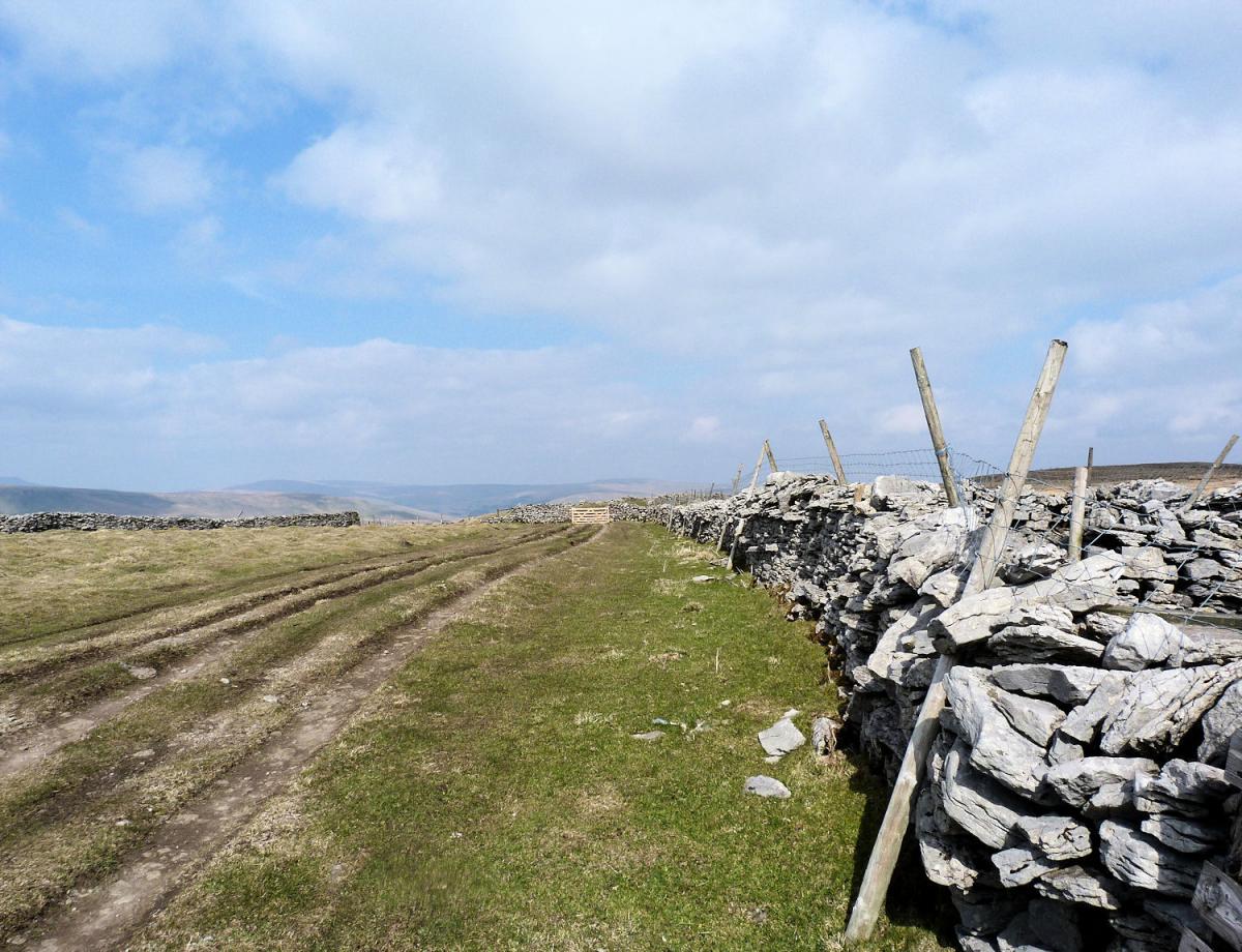
This is the Pennine Way, possibly the most famous and certainly the longest established long distance footpath in England, stretching for over 200 miles from the Peak District to the English/Scottish border. For the next 3 miles we will follow the footpath (initially a walled lane, then a footpath across fields before turning in to a farm track) as it steadily climbs up the hillside. The gradient is never steep and the views all around improve with every step. My favourite is behind to the north where Great Shunner Fell stands out to great effect.
After 3 miles the land to your left starts to rise significantly. At this point (and there is no exact best place to leave) leave the track and start climbing up the rough ground of the mountain. This is access land so simply pick the best route for the 300 foot climb to the high point of Dodd Fell Hill. There is a trig point at the summit and great views all around. From the trig point the second mountain of the trip stands tantalisingly north east. However the deep valley of Sleddale and more particularly Bank Gill lies between so head south away from the target and drop down some rough but manageable ground to the high moorland track/road known as the Cam Road. Turn left and walk for nearly 1 mile till the road meets the Wharfedale/Hawes vehicular road. You are now heading north.
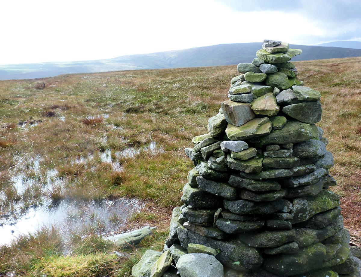
After less than ½ a mile follow a farm track from the road forking to the right which soon passes under a mountain to your left. The bulky area is known as Wether Hill but the summit is called the more attractive name of Drumaldrace. The high point (signified by a large cairn) lies only 200 metres off the track, a barely visible path on the ground does lead there but best take a compass in case. Return to the track and enjoy the views east over Addleborough and down in to Wensleydale. Immediately after the track passes through a gate in a wall take a bridlepath heading due north that picks its way down the hillside. After passing through two further gates a footpath leaves the bridlepath to the left and heads directly towards Gayle and Hawes passing over a number of stiles before arriving at Gayle at the stone bridge near the mill.
Jonathan Smith runs Where2walk, an outdoor business in the Yorkshire Dales. He has written his own book, the Dales 30, which describes the highest mountains in the Dales. He also runs one-day navigation courses for beginners and intermediates, and learn a skill, climb a hill weekends. To find out more details on any of the above and details of many more walks in the area visit where2walk.co.uk

WALK FACTS
Distance: Roughly 11 miles (18km).
Height to Climb: 580m (1,900 feet)
Start: SD 870895. Park on the road near the Wensleydale Creamery.
Difficulty: Hard. A long day mainly on good tracks but with 2 detours in to rougher ground maybe needing some compass skills in bad weather.
Refreshments: Hawes has plenty of places to eat and drink.
Be Prepared: The route description and sketch map only provide a guide to the walk. You must take out and be able to read a map (O/S Explorer 297) and in cloudy/misty conditions a compass (essential on this walk). You must also wear the correct clothing and footwear for the outdoors. Whilst every effort is made to provide accurate information, walkers head out at their own risk.
Please observe the Countryside Code and park sensibly.


Comments: Our rules
We want our comments to be a lively and valuable part of our community - a place where readers can debate and engage with the most important local issues. The ability to comment on our stories is a privilege, not a right, however, and that privilege may be withdrawn if it is abused or misused.
Please report any comments that break our rules.
Read the rules here