
WHERNSIDE (at 2,415ft/736m) is the highest mountain in Yorkshire. It is climbed regularly from its south side at Ribblehead but a much more enjoyable, and quieter route starts near Dent and returns via the lovely Deepdale.
1 ½ miles to the west of Dent on the southern banks of the River Dee is Whernside Manor. Just before reaching the manor the road divides, a minor track heading south in to Deepdale. There is some limited parking juts up from the junction on the right hand side. Turn right and a few yards further a bridlepath is signposted heading west on to the steep hillside. The path climbs steadily up a wide track for 250 m (over 800 feet) to the first of a series of walls coming in from the hillside to your right. On route pass the small satellite, a chance to glance around and enjoy the views back along Dentdale.
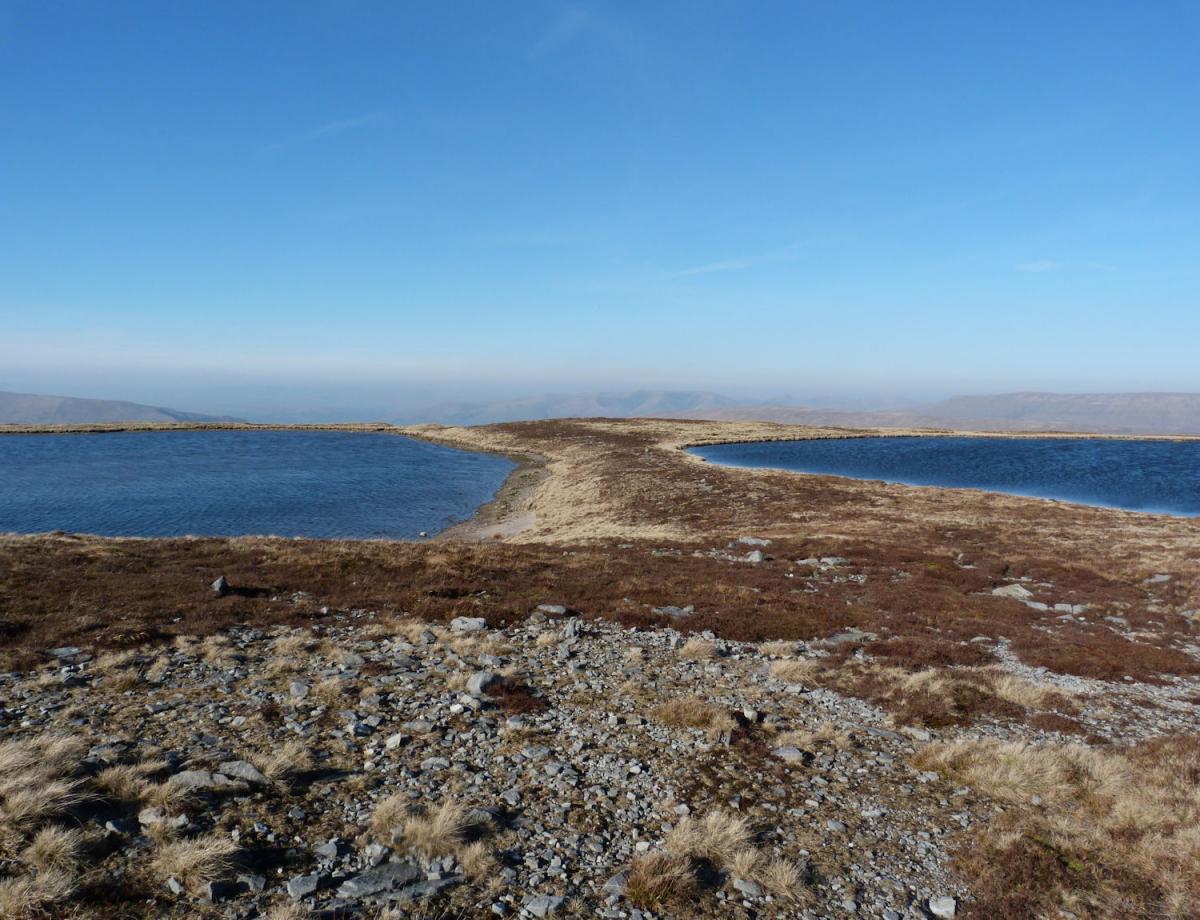
The stony track starts to decrease in steepness as it passes a further 3 walls on your right and a sheepfold. After the 3rd wall (at the Boot of the Wold!) leave the track and head steeply uphill along a faint path, keeping the wall to your right. Where the wall bends right keep climbing along the faint path until it flattens at the first of the Whernside Tarns. It is worth spending time exploring these tarns and in particular head for a large and obvious cairn to the east where there are spectacular views over Dentdale to the Howgills and beyond. This ability to roam in such a lovely landscape is the joy of our mainly upland Access Land. Long may it be preserved. Return to the track at the first tarn and head north.
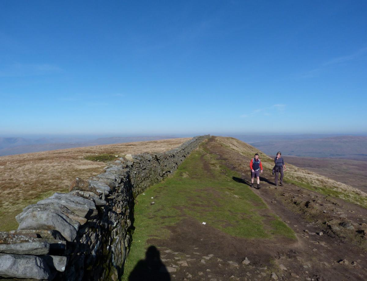
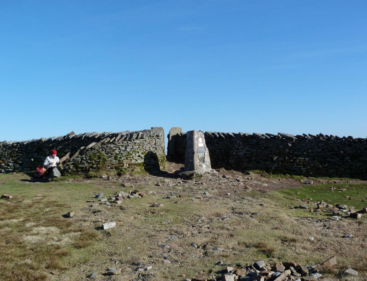
After a welcome period of flat walking the path starts to climb again and closes in on a broken wall and fence to your left. Where the path meets the wall is a small stile, cross over ad join the obvious and popular path heading for ¾ a mile towards the summit of Whernside’s long and broad whaleback ridge. Unlike its distinctive millstone grit flat tooped neighbours Pen y Ghent and Ingleborough the top of Whernside is a graceful curve, peaking at a shelter and trig point astride the now solid stone wall. The views to the east include the other 3 Peaks and the beautiful curve of the Ribblehead viaduct but crossing the wall to the trig brings wilder country and views over neighbouring Great Coum and Calf Top, 2 more of the ‘Dales 30‘ series of mountains.
From the trig point head west and taking a faint path descend the mountain for 1,000 feet by a series of rolling steps, steep descent intermixed with flatter areas. A wall emerges to your right half way to the road and operates as a good handrail. On meeting the road turn right and follow it south as it drops in to the farming valley of Deepdale. As the road zig zags at 721836 leave it briefly and visit one of a number of delightful small waterfalls. After a further ½ mile at Willans Farm take the bridlepath down to the river at the foot of Deepdale, cross the foorbridge and return to the car.
Jonathan Smith runs Where2walk, an outdoor business in the Yorkshire Dales. He has written his own book, the Dales 30, which describes the highest mountains in the Dales. He also runs one-day navigation courses for beginners and intermediates, and learn a skill, climb a hill weekends. To find out more details on any of the above and details of many more walks in the area visit
where2walk.co.ukWALK FACTS

Distance: Roughly 8.5 miles
Height to Climb: 640m (2,100 feet).
Start: SD 723858. Small parking area at the junction near Whernside Manor. Alternatively leave the car at Dent adding 3 miles to the round trip.
Difficulty: Hard: This is a long climb and some of the walking is on intermittent paths which can become wet and muddy.
Refreshments: Nearby Dent has pubs and cafes.
Be Prepared:
The route description and sketch map only provide a guide to the walk. You must take out and be able to read a map (O/S Explorer OL2) and in cloudy/misty conditions a compass (essential on this walk). You must also wear the correct clothing and footwear for the outdoors. Whilst every effort is made to provide accurate information, walkers head out at their own risk.
Please observe the Countryside Code and park sensibly.


Comments: Our rules
We want our comments to be a lively and valuable part of our community - a place where readers can debate and engage with the most important local issues. The ability to comment on our stories is a privilege, not a right, however, and that privilege may be withdrawn if it is abused or misused.
Please report any comments that break our rules.
Read the rules here