
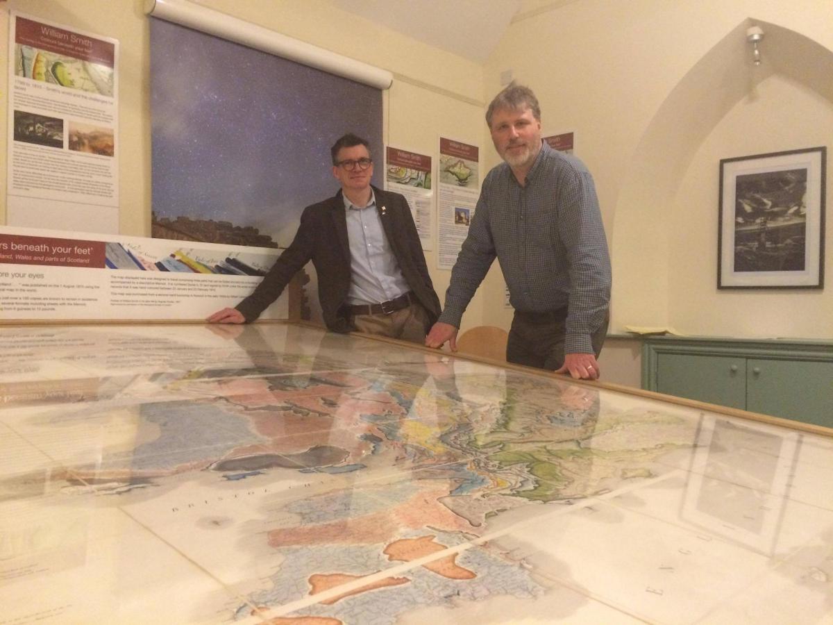
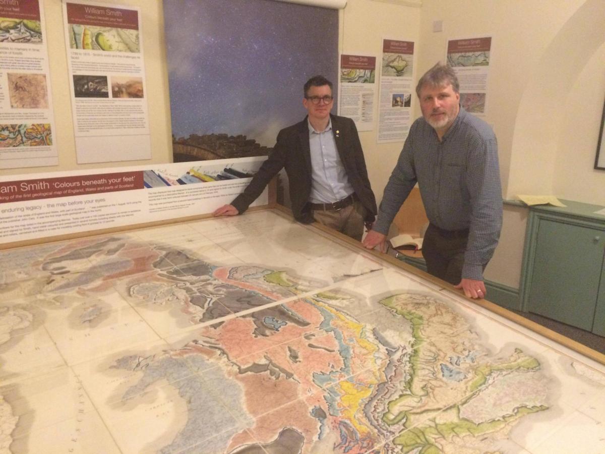
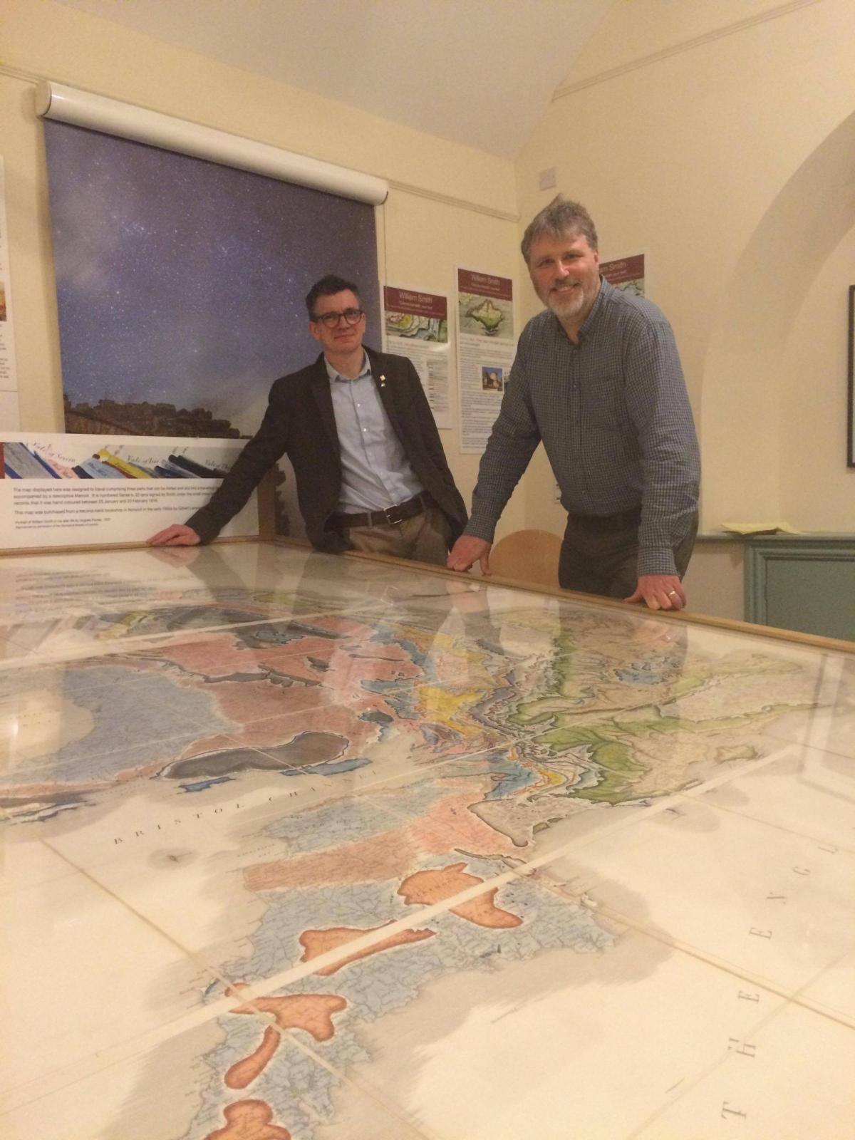
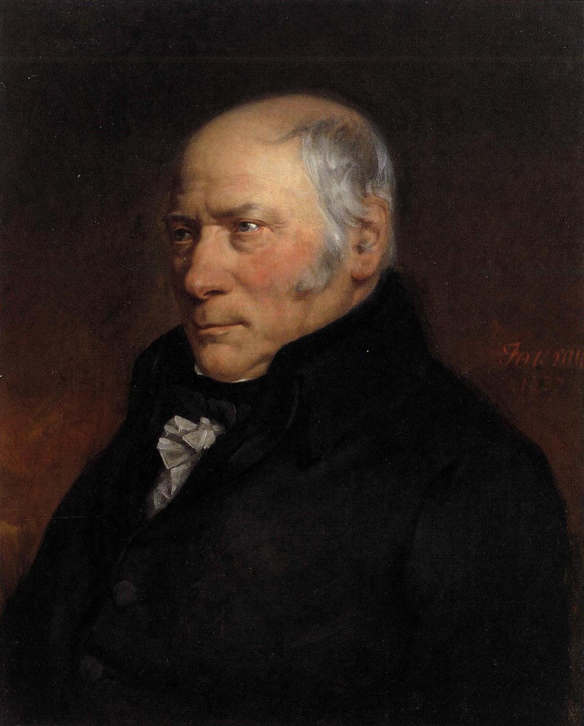
AN original example of a map produced by the 'Father of English Geology' has gone on display as part of a new exhibition.
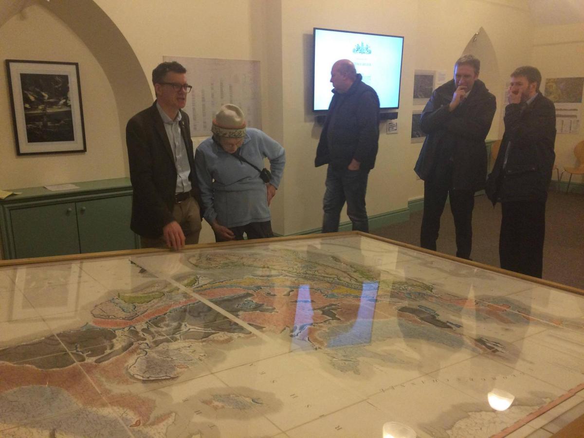
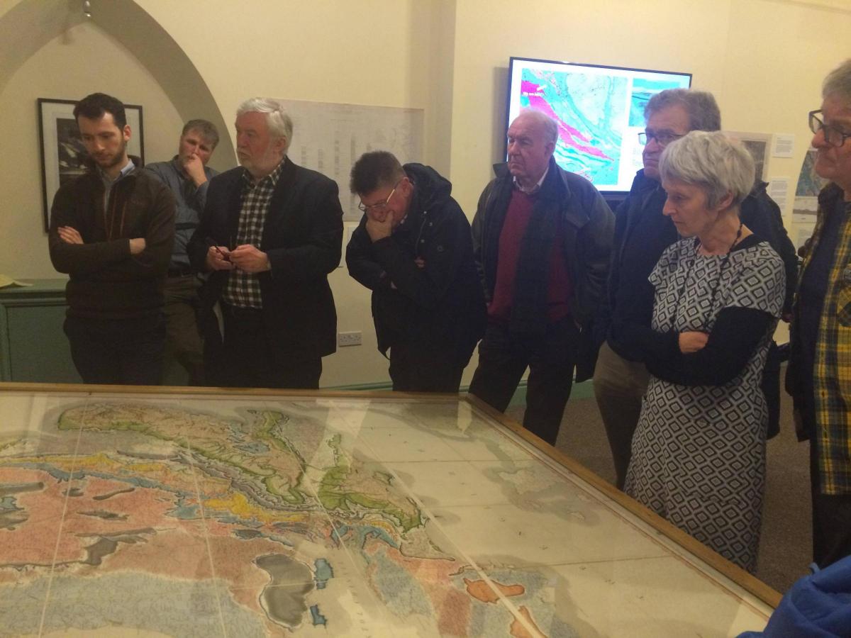
Visitors to Bowlees Visitor Centre, in Upper Teesdale, were the first to see geologist William Smith's map on Friday night as part of a new geo-heritage project launched by the North Pennines Area of Outstanding Natural Beauty Partnership (North Pennines AONB).
The travel map, which was produced in 1815, is at the centre of the AONB's Earthworks project, which will receive £376,200 from the Heritage Lottery Fund over the next three years.
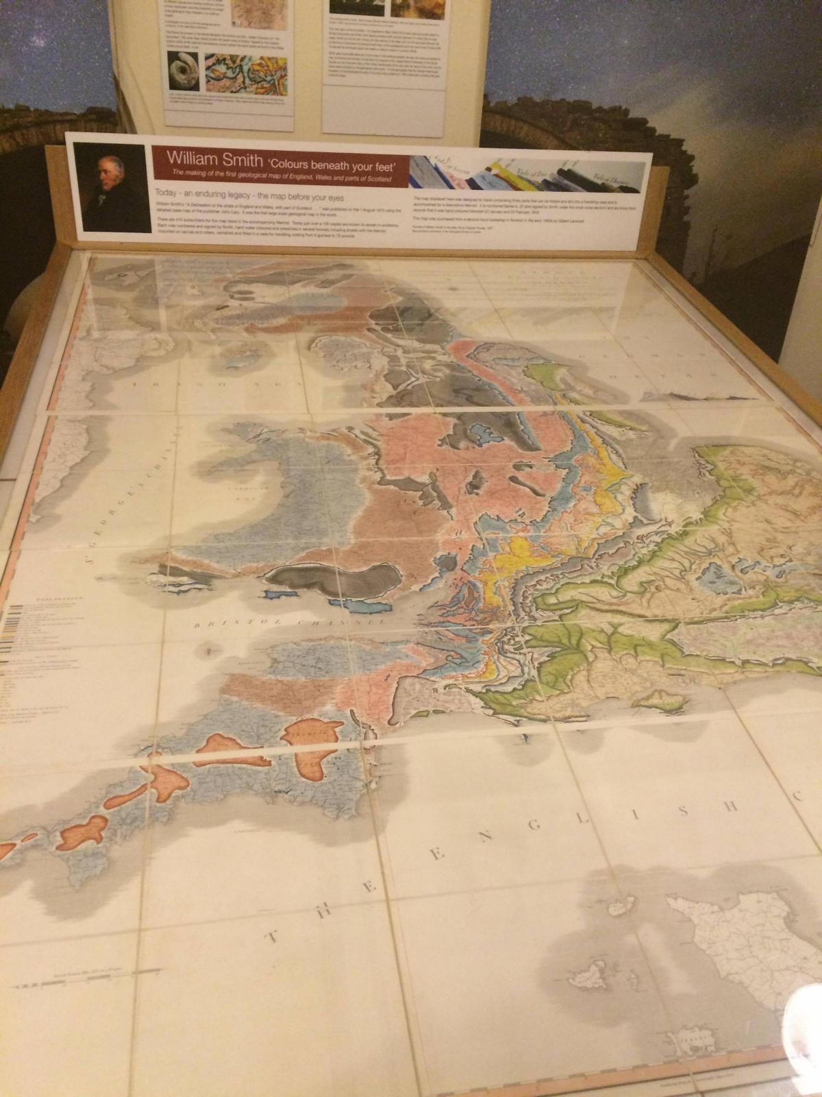
It is the world’s first countrywide geological map and often known as the map that changed the world as Smith, a surveyor and engineer, travelled the length and breadth of Britain collecting data to create A Delineation of the Strata of England and Wales, with part of Scotland.
The exhibition takes visitors through the evolution of geological mapping, from Smith’s ground-breaking work, to modern maps.
Smith’s map uses familiar symbols to mark out features such as rivers and roads, as well as mines and other industrial sites. He then applied layers of different colours, by hand, to indicate the various rock types; techniques that are still used.
Natural England geologist and owner Jonathan Larwood, worked closely with the Partnership on the exhibition and gave special guests at the launch event an insight into its history.
He said: “Smith’s map is an important piece of national scientific heritage and it is great to see it travelling to the North Pennines. The exhibition charts Smith’s process for creating the map, but also tells the human story behind it: Smith’s remarkable rise from humble beginnings to renowned geologist. What he was able to do in his lifetime set the scene for other scientists to progress the work and make further strides in geological study.”
The National Lottery funding for Earthworks will enable the Partnership to expand its work in support of the North Pennines' UNESCO Global Geopark designation, one of only four UNESCO designations in the North East and Cumbria.
The project will see the creation of new IT-based interpretation of geology and landscape, new walking trails, temporary visual artworks, work in schools and new community projects.
Inspired by the map and exhibition there will be four felt-making workshops for the public, to be held at Bowlees Visitor Centre during April and May.
Chris Woodley-Stewart, North Pennines AONB Partnership Director, said: “Bringing this William Smith map to the North Pennines is an important first stage in our Earthworks project. Earthworks will help us to bring this area’s geological heritage to life, and we are looking forward to telling the North Pennines’ fascinating story of ancient tropical seas, vast deserts, moving continents, huge ice sheets, magma and minerals.
“We're grateful to HLF, and to National Lottery players, for supporting this geo-heritage project, and helping us to develop education, the visitor economy and local people's enjoyment of the area.”
Ivor Crowther, head of the Heritage Lottery Fund North East, said: “This project will allow people to learn more about the geology of the North Pennines, through an engaging and interactive programme of activity over the next three years.
"It is great to see that the Earthworks project is launching with such a prestigious piece of scientific history, in the form of the William Smith map.
"We are delighted to be supporting the North Pennines AONB Partnership to help people to connect with the geological heritage of this fascinating area.”
The exhibition is free and runs until June 10. Contact Bowlees Visitor Centre on 01833-622145 or email mandy@northpenninesaonb.org.uk for more information.


Comments: Our rules
We want our comments to be a lively and valuable part of our community - a place where readers can debate and engage with the most important local issues. The ability to comment on our stories is a privilege, not a right, however, and that privilege may be withdrawn if it is abused or misused.
Please report any comments that break our rules.
Read the rules hereLast Updated:
Report this comment Cancel