

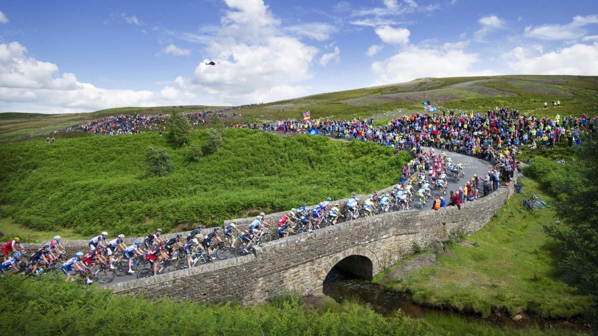
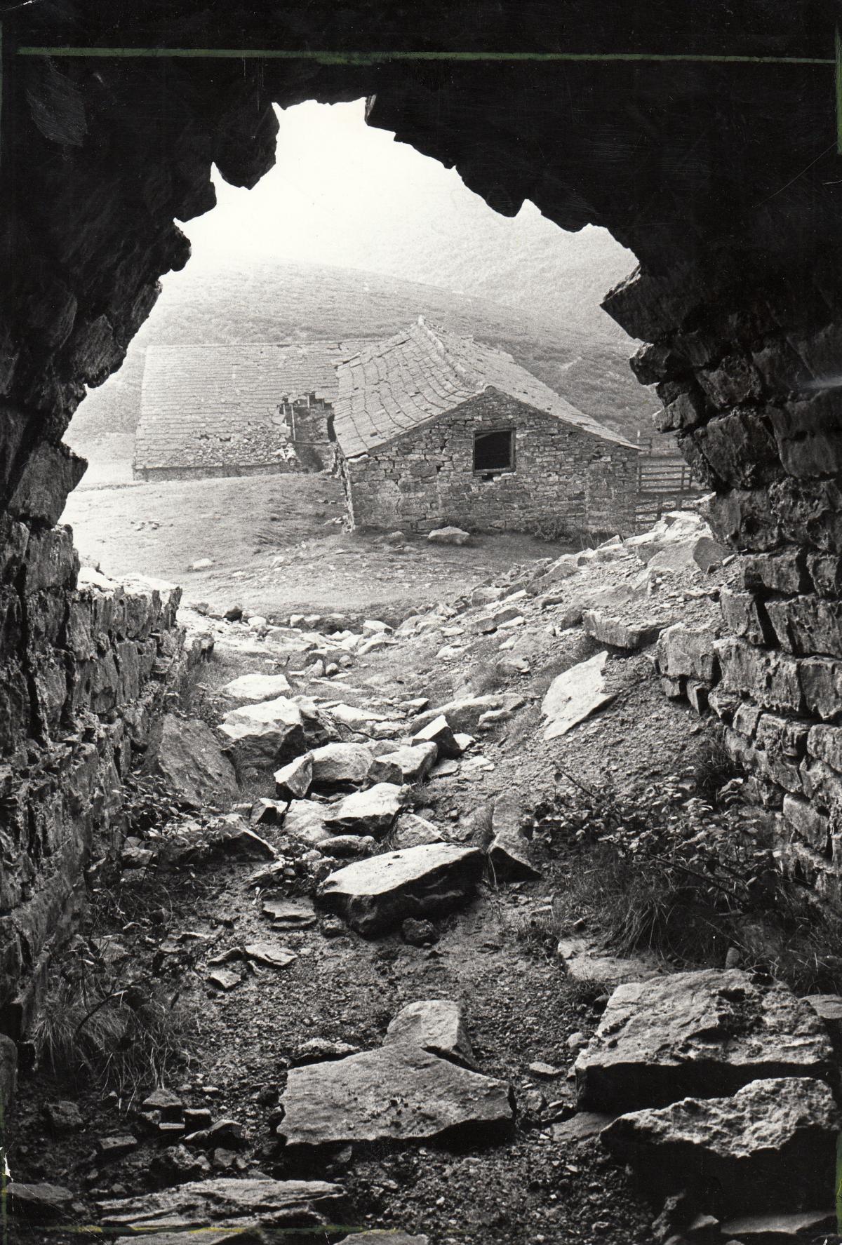
IT was on the heathery moor above Cogden Beck bridge on the Côte de Grinton that the Memories found a vantage point to watch the 2014 Tour de France take on one of Yorkshire’s most severe climbs.
The road’s search for a suitable crossing of the small but steep-sided Cogden Gill created a panoramic and picturesque turn which showed off the snake of cyclists pedalling over an old stone, leadminers’ bridge.
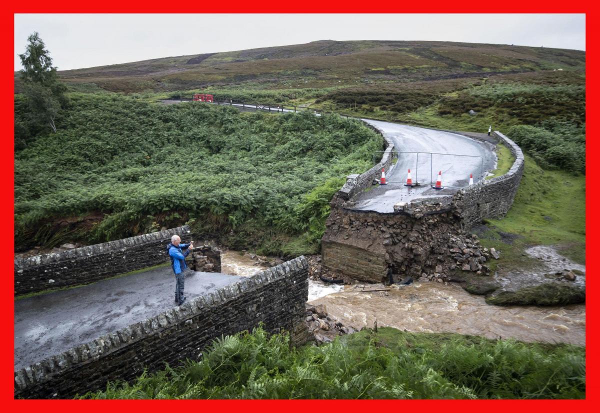
The bridge had stood since Victorian times but last week it was washed away.
This south bank of Swaledale is riddled with old leadmining works. Old Ordnance Survey maps show paths immediately below the bridge which cross the beck at a ford and via stepping stones as the determined miners tried to take the most direct route to work.
Modern Ordnance Survey maps name the hushes all around it – a hush was a natural ravine at the top of which the miners built a reservoir and then unleashed the water to wash away the vegetation and reveal the lead ore. There’s Swinston, Ridley, How and Cart Wheel hushes all rolling down the daleside into the gill.
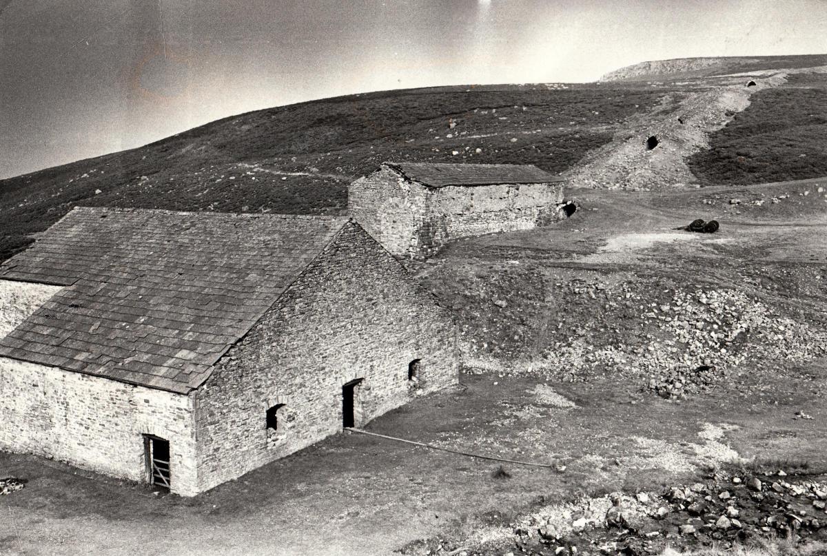
And, just a short stroll up from the washed-away bridge, there are the remains of the best preserved lead mill in the Yorkshire Dales.
It is the Grinton Smelt Mill, complete with a flue running 290 metres up the side of the dale.
One of the difficulties of leadmining was that the ore was very heavy, so it was economical to build a smelting mill near the mines and only carry down to civilisation the lead that was really saleable.
Lead has been worked in the Grinton area since at least the 2nd Century BC. The first properly recorded note of leadmining is from 1219.
There may have been a mill up in Cogden Gill, built from stone quarried nearby, in the 16th Century; it was definitely there, owned by the Marriott family, in the early 18th Century. In 1758, when it was owned by the London Lead Company, it produced 3,884 pieces of lead, weighing about 194 tons, but by 1803, when it was bought by the Whitelocks of Cogden Hall, it was all but ruined.
It was they who rebuilt it in 1820-22, creating much of what can still be seen today.
It had a couple of furnaces in which wood, peat and coal were mixed with the ore, and superheated by blasts from large bellows.
The bellows were powered by a six metre wooden waterwheel on the side of the mill which was turned by the water running down the gill (above the mill, it is known as Lemon Gill; below it, it becomes Cogden Gill).
The slag leftover at the end of the heating process was usually reheated in another furnace, this time with charcoal which burns at a higher temperature and so the very last pieces of the precious metal were melted out.
And it really was precious, which is why the flue was built running 45 degrees up the side of the dale to a chimney on the top of Sharrow Hill.
If the miners had just wanted to get rid of smoke and fumes from their furnaces, they would have vented their mill with a traditional chimney, but they wanted to squeeze the last bit of value out of the ore, so they built the flue to act as a condenser. The fumes on their way up rubbed on the stonework of the flue, coating it with lead and silver deposits, which small boys were despatched into the toxic dark to recover.
In 1851, the Grinton mill was one of 32 in Swaledale and Arkengarthdale, and the area was home to 1,129 leadminers – even though leadmining was slipping into terminal decline.
The Grinton Mining and Smelting Company was dissolved in 1895, and the mill never smelted again, which also meant the end of the road for the 90 men working in the mines, shafts, pits, veins and hushes which supplied it.
It is considered to be the best preserved of the 87 known lead mill sites in the Yorkshire Dales – if it has survived the flood that washed away its road bridge.
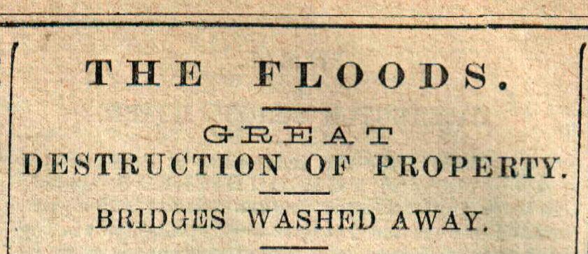
THIS isn’t the first time that Cogden has featured in reports about severe flooding. For instance, Swaledale was badly hit in early February 1883.
“On Monday, the flood came down early in the morning, sweeping almost all before it,” said the D&S Times of February 3, 1883. “Scarcely anything escaped at the foot of the steep, precipitous hills.”
Bridges over the Swale at Gunnerside, Low Row and Scabbawath were washed away. “A large part of the mining plant of Sir Francis Mine (in Gunnerside Gill) was washed away and much damage was done amongst the mines in other places.
“At Reeth, where the Arkle, a strong and rapid stream from Arkengarthdale, runs into the River Swale, the inhabitants at the lower part of the town were awoke by a noise of water rushing into their houses.” The D&S said their houses were “deeply inundated”, as indeed they were last week.
However, the landowner who sustained the greatest individual loss was Mr Ernest Whitelock of Cogden Hall, who lost more than 200 ewes, valued at £500.
“On his farm,” said The Northern Echo, “a bridge has been washed down, and scores of acres next the Swale are thickly covered with sand and all descriptions of debris. £1,000 will hardly cover the loss sustained by this gentleman.”
One wonders if his lead smelting mill survived.
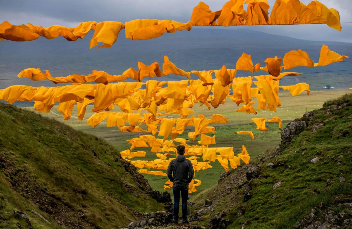
STICKING with leadmining, a fortnight ago, we were enraptured by the artwork – one of the largest outdoor artworks in the country – that had been strung across Bales Hush at Bowlees in upper Teesdale. Twenty or so lines of saffron yellow sheeting, like so much washing on a Buddhist’s line, had been suspended to dramatic effect.
As if sensing that we were desperate to know more about the area, Desmond Collinson, of Middleton-in-Teesdale, has kindly sent in some information which comes from his family tree research.
This shows that the area was originally known simply as Bayles, as a Mr Bayles’ sheep were hefted there on Newbiggin Common. On August 15, 1731, William Tinkler, Joseph Collinson, John Bainbridge and John Elliott took out a lease to work an area of 800 yards by 100 yards at Bayles for 21 years, and from then on it was known as Bayles Hush.
In 1808, Desmond found that Bayles Hush was being worked by Armstrong and Company, which he suspects was connected to Mark Armstrong who, after an unsuccessful venture in upper Teesdale, is known to have struck it rich at Lodge Syke in Hudes Hope – a dale to the north of Middleton-in-Teesdale which has a U-shaped road ideal for a drive around a leftover lead landscape.
“Lodge Syke was one of the richest leadmines in the country,” says Desmond. “In six weeks, they produced an amazing 1,212 bings of ore, and in one year, they sent 16,000 bings of ore to the smelting mill.”
Hold onto your hats. In northern Pennine leadmining circles, 1 piggin = 56lbs; 2 piggins = 1 hoppitt; 2 hoppitts = 1 horseload = 16 stone; 8 hoppitts = 4 horse = 1 bing = 64 stone.
Says Desmond: “In an 1821 list of Teesdale leadmines, an Armstrong Vein is mentioned. It is described as being six-and-a-half miles north-east of Middleton, and I think this refers to Bayles Hush. It was said to produce “much lead, with some fluorspar and honeycomb, or vesicular iron spar”.”
When asked what honeycomb might be, Desmond said: “I’m really a farmer…”
Which is fair enough. The Oxford English Dictionary defines “vesicular” as being something with “the shape or form of a vesicle; bladder-like”.
So they must have been getting some extraordinary minerals out of Bayles Hush long before it was strung up with saffron yellow sails.


Comments: Our rules
We want our comments to be a lively and valuable part of our community - a place where readers can debate and engage with the most important local issues. The ability to comment on our stories is a privilege, not a right, however, and that privilege may be withdrawn if it is abused or misused.
Please report any comments that break our rules.
Read the rules here