

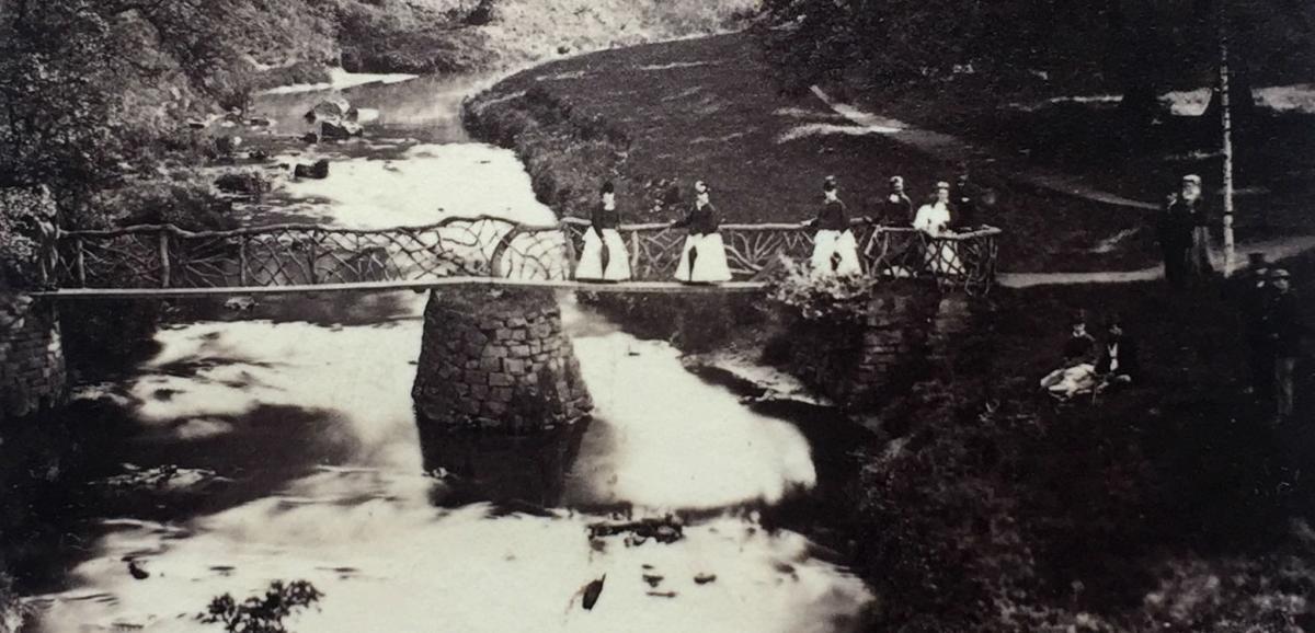


VICTORIAN women in wide, white skirts clutch umbrellas in one hand and cling with the other to a rather rustic rail, which stops them plummeting into the foaming river below, while a photographer above them captures them forever.
But what bridge are they standing on? What river are they crossing?
The picture appeared on the front of Memories 370. It comes from the “Maddison archive”, which is an album of photographs that we think are from the second half of the 1880s. The album, which has been kindly lent to us by Doreen and Geoff Spence of Darlington, was put together by a member of the Maddison family, who lived in Darlington but ran a successful mineral and stone business based on the quarries of Weardale.
The photograph has “Bp Auckland” pencilled underneath it, and the only other picture on that page of the album shows Auckland Castle.
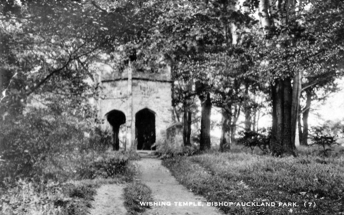
In Memories 370, we said the bridge was in Auckland Park, spanning the Gaunless to reach a folly called The Temple.
Lots of people questioned us as they remember the bridge to The Temple being a simpler, safer crossing, and we reckon they are right. But, as the map shows, we think the photographer was standing elsewhere in the park, photographing the ladies on a bridge that disappeared long before living memory.
Are we right?
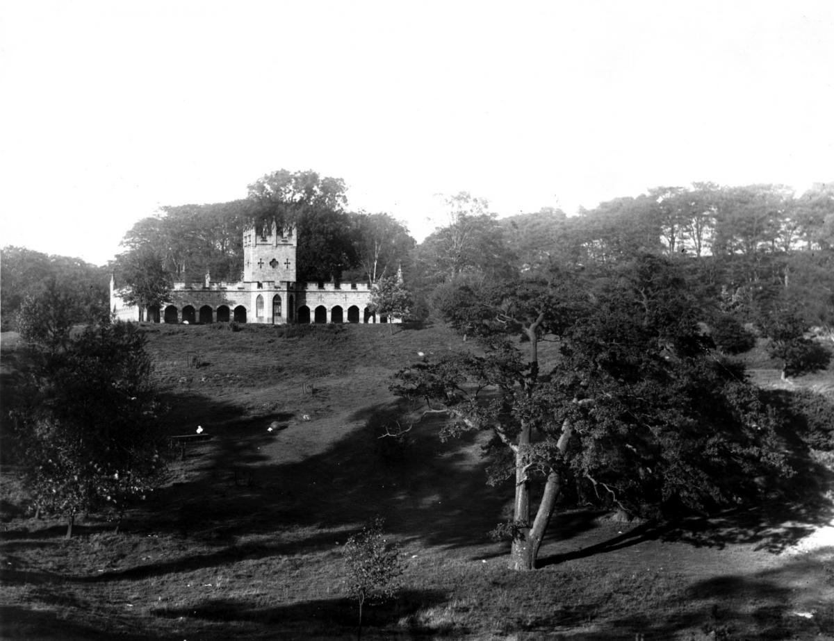
Auckland Park was the pleasureground of Auckland Castle, the principal home of the Bishop of Durham.
It is a dramatic landscape, tumbling steeply from the castle down grassy hills to the winding River Gaunless, and then rising abruptly up tree-lined cliffs to the plains on the far side.
From the 12th Century, the bishop was hunting deer in his park – in England, all deer belonged to the monarch, except in the Palatinate of Durham where they belonged to the all-powerful bishop.
He also had fish ponds, rabbit warrens and a herd of rare white cattle in his park – that’s why in 1349, he paid £40 to have stone wall built around his boundary, to keep his animals in and to keep the peasant poachers out.
In the 18th Century, Bishop Richard Trevor spent a fortune – £16,000, or £3m in today’s values – upgrading castle and park. Aided by Jeremiah Dixon, the famous surveyor from Cockfield Fell, he built a sweeping carriageway through the park that became his main driveway to Durham.
He built a deerhouse on a plateau overlooking the Gaunless, and at the top of the deerhouse’s south tower was a banqueting room with splendid views over the park.
Pathways were created, following the contours of the land, taking the visitor into unexpected corners of delight.
Although there are several bridges and culverts to be found in the park over smaller watercourses, we reckon there have been four spanning the Gaunless:
Jock’s Bridge
In the north, near the confluence of the Gaunless and the Wear, Jock’s Bridge carries the road outside the park – although the eastern parapet of the bridge doubles as the wall of the park, and from inside the park, you can see the datestone “SD 1819”, indicating that it was built by Bp Shute Barrington (his episcopal name was Shute Dunelm).
Outside the park near the bridge was a row of peasant houses – the inhabitants may have been of Scottish origin, or the memorable landlord of one of the pubs might have been loudly Scotch. It is said that these rough, tough types cut one of their fingers off their own right hands so they couldn’t operate a bow which meant they wouldn’t be called up for the English army.
Carriage bridge
Its keystone says “RD 1757”, showing it was built by Bp Richard Trevor on the carriageway that led through the park to Coundon Gate.
During the construction, workmen discovered “a Roman urn of greyish clay…filled with earth and human bones”.
Shonky footbridge
This, we now reckon, is the footbridge in our picture – it only has one shonky-looking handrail, which our ladies are clinging to. It was marked on the 1857 Ordnance Survey but had gone when the 1896 map was drawn.
It is below the deerhouse plateau, and it appears to cross the Gaunless to reach a low-lying piece of land where, on November 5, 1841, Bp Edward Maltby and his son, the Rev Henry Maltby, each planted an oak sapling. Their trees can still be seen, with moss-covered, inscribed stones, about a foot high, at their feet. Perhaps it was to access these trees that our primitive bridge was built?
The ladies appear to be looking up at a photographer who is standing on a promontory, near the deerhouse, as our map shows.
If we are right, this appears to be the only picture of this bridge to have survived.
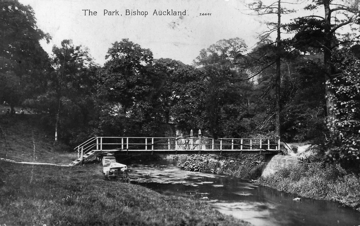
Temple footbridge
In 1810, during Bp Barrington’s reign, a folly, known as The Temple, was tucked away in the trees on the east bank of the Gaunless. It was reached by a zig-zag path which crossed the river on a plain bridge.
First World War era postcards show it is a single plank, with two handrails, but later views show it with a central pillar. It was in use until the 1950s, but does not appear on a 1962 map – this would coincide with the removal of the temple, which we know was dismantled in 1961.
So, are we right? Would a bishop with unlimited funds at his disposal build such a shonky bridge in his palatial parkland? Would not such a rustic affair be more likely to have been built up t’dale? If you’re visiting the Bishop Auckland Food Festival this weekend, have a peek in the park and have a look. If you’ve get a different theory about our bridge, please let us know.
With thanks to local historians Tom Hutchinson and Barbara Laurie who may, or may not, agree with us


Comments: Our rules
We want our comments to be a lively and valuable part of our community - a place where readers can debate and engage with the most important local issues. The ability to comment on our stories is a privilege, not a right, however, and that privilege may be withdrawn if it is abused or misused.
Please report any comments that break our rules.
Read the rules here